This was the result of a hastily thought out question from me to the OM a year ago. With my impending 50th on the horizon, I really needed a challenge and something different. I am not sure why Bass Strait came to mind, but I found myself asking him one day – “how about a Bass Strait crossing?” There was hardly a moments’ hesitation and the answer was “yes”. At that moment, I had huge second thoughts but the plan was hatched!
After getting back from Bhutan in October, I managed to tweak one of my knees and after an arthroscopy, we started more regular training/paddling in December. Most of this was in the Channel/Derwent to save long drives, but we started to clock up the kilometres. We had lots of funny exchanges via email while planning the paddles – for example;
From Laurie:
Tomorrow at Marieville Esplanade just look for the old bloke
with the walking stick.
At 08:07 PM 10/03/2016, you wrote:
Sorry OM for the elder – abuse.
I suppose I just don’t think about you
being “elderly”!!!!
GG
Anyway, the plan was hatched, the boat booked from Devonport to Melbourne and we would soon be on our way!
March 28th 2016
Garth and I collected Laurie mid/late morning and we made our way to
Devonport. The latter had brought a supply of egg and bacon pies
to eat on the way, but as I was my usual disorganised self, we stopped
on the way for food and caffeine. The set-up in Devonport was very
organised with separate lanes for the bigger vehicles and before long we
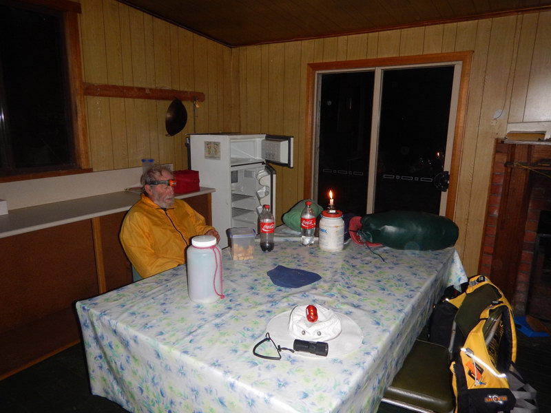
found our cabin and went for a couple of drinks before bed.
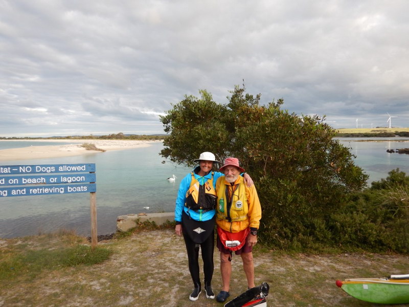
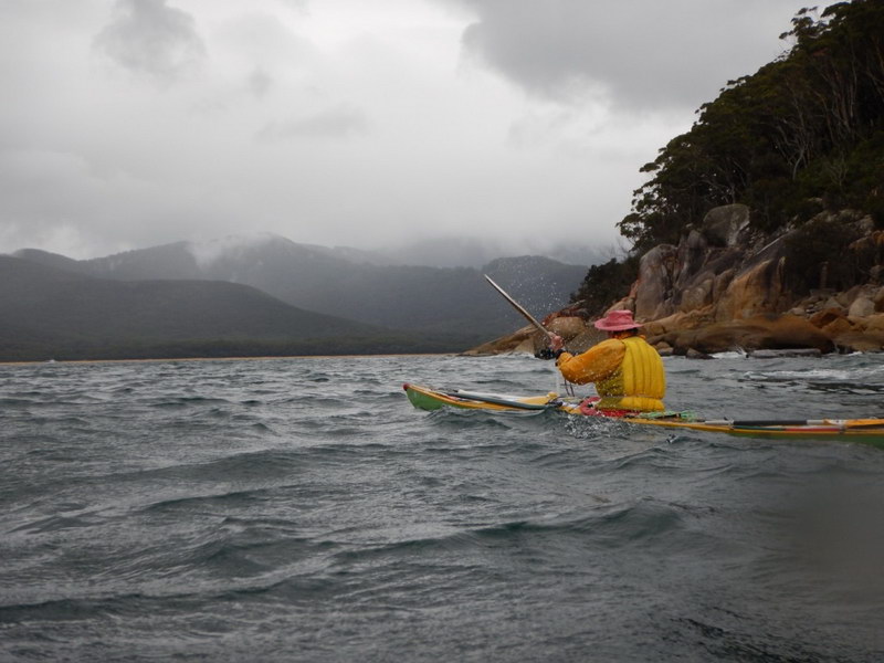
March 29th 2016 – Port Welshpool to Suzie-May Bay
The wake-up call came at about 0530 and we got ready to go down to
the car. Arrived at Port Welshpool at 10.30ish and slowly packed
up. Luckily all went in ok and we headed off. The nerves were
definitely on edge as we left, thinking about the trip ahead and whether
I was sufficiently prepared. OM had a laugh with me telling Garth
to drive safely home, when we on the other hand, were heading across Bass
Strait!
For the first ½ - 1 hour the tide was still ebbing and so we
had a little assistance, but after than we paddled against it and a 5-10
knot head wind. We had to do a wide berth of Snake Island because
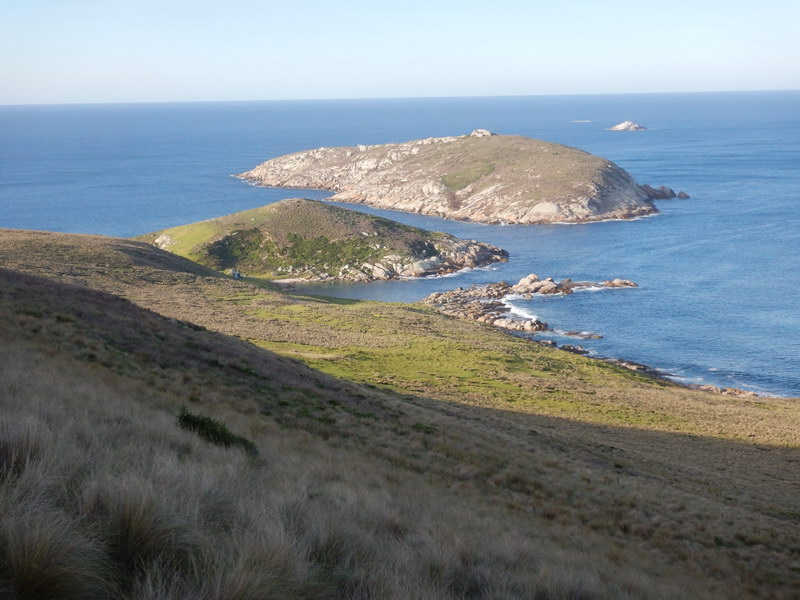
of the low tide and very shallow seas. After about 4.5 hours we arrived
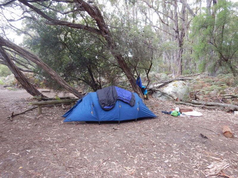
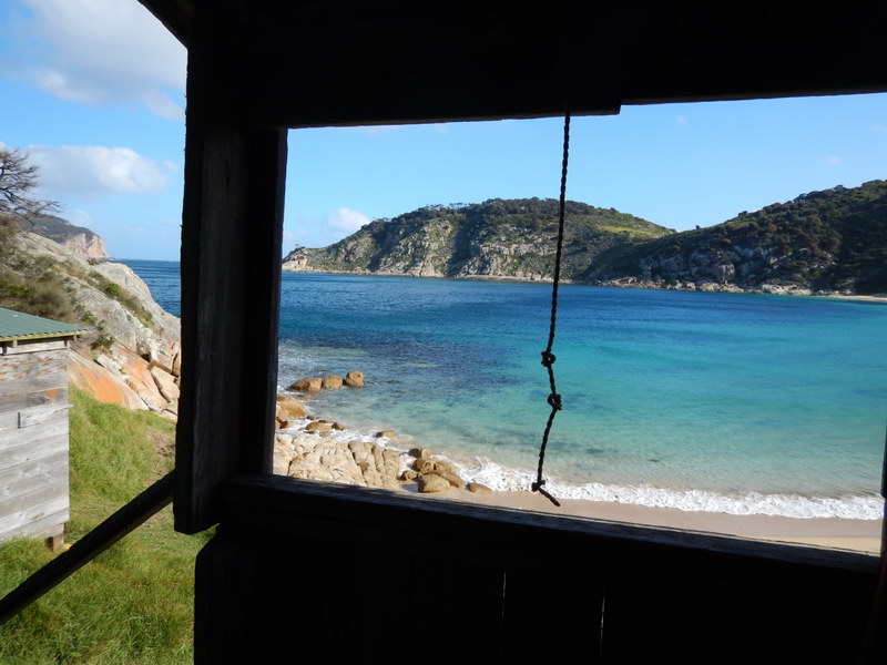
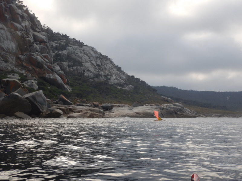
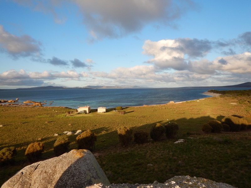
at what we thought was Johnny Souey Bay and made camp underneath some sheoaks
in the centre of the beach. Lovely sheltered spot and had a small
campfire while having dinner. We named the place Suzie May Bay instead.
Discovered that my SPOT tracker wasn't working for those trying to
see where we were, so altered a few settings on-line (luckily there was
phone reception) which resolved the problem. Bed at 9ish and slept
like a log.
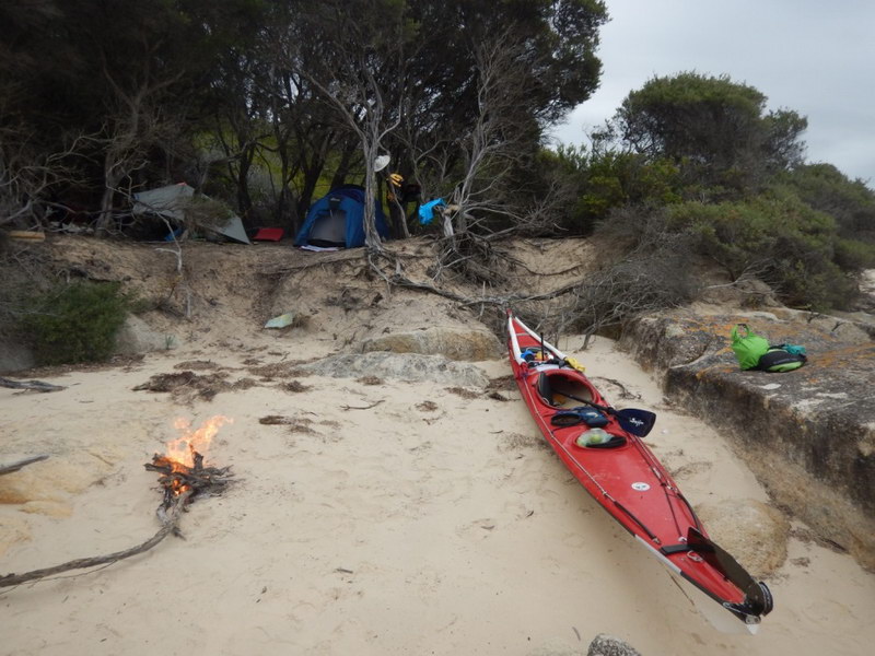
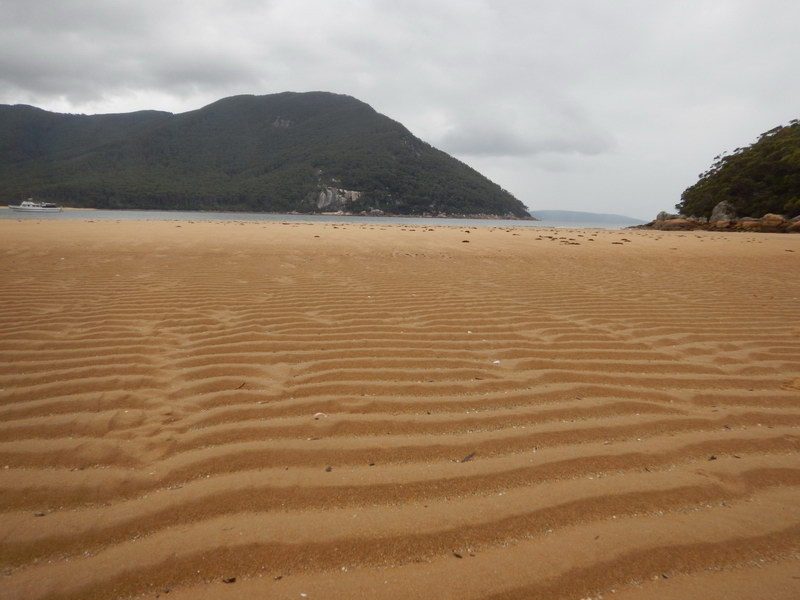
Suzie May Beach
March 30th - Suzie-May Bay to Refuge Cove
We left just after 8.15am and initially there was no wind. Around
the first point south of Suzie-May Bay they started and we had up to 20
knot gusting winds. There was a bit of clapotis near the points but
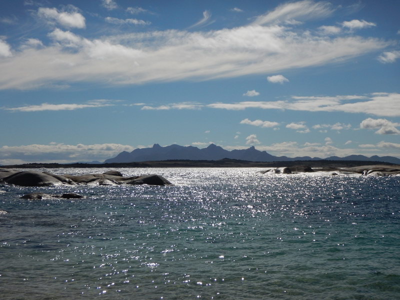
it was fine to paddle especially as there were amazing views of Wilsons
Promontory NP and of a group of 5 sea eagles playing in the thermals.
I don’t think that I have ever seen so many eagles together in this way.
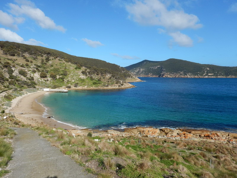
A short stop at Johnny Souey Bay made us realise that we had had a much
better campsite the night before. We had lunch and a break
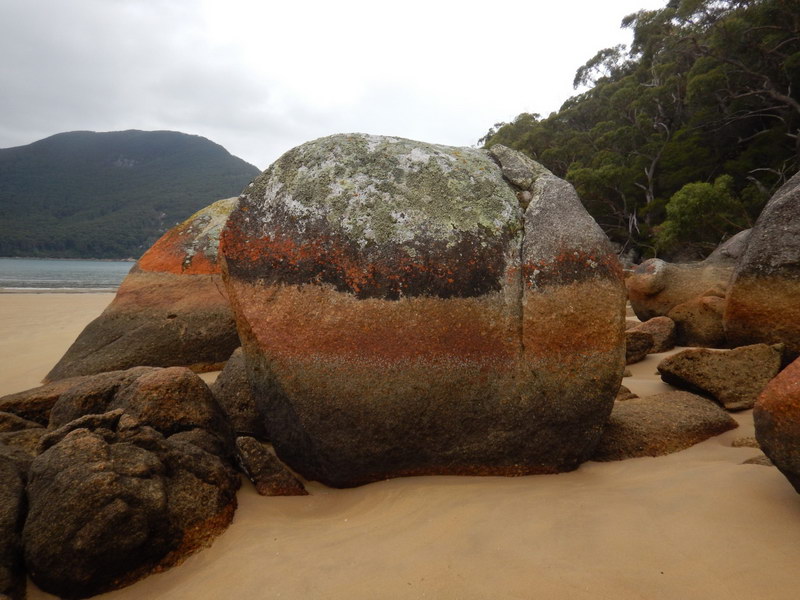
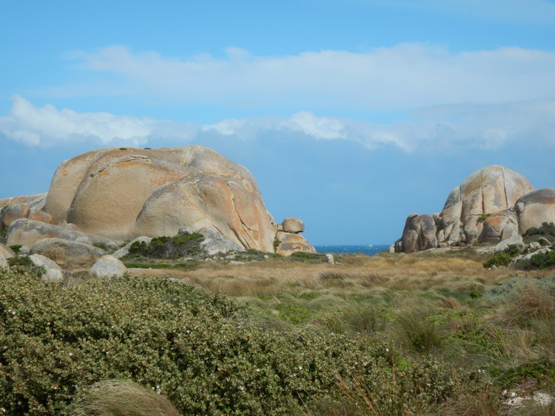
at Sealer’s Cove where the rocks and sand patterns were amazing.
The campsite there was ok but the views made up for this.
Sealers Cove
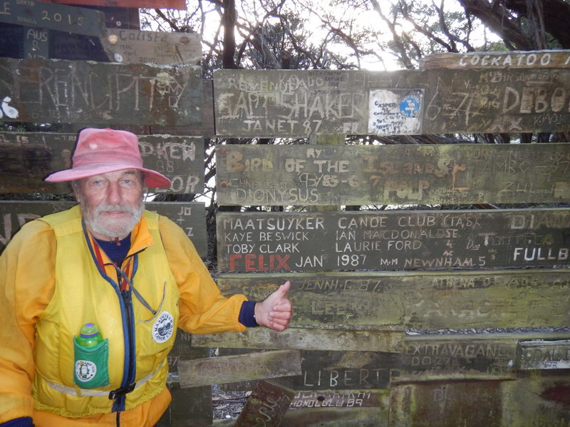
We then had a further hour to Refuge Cove in lumpy seas and a headwind. At the northern end of the beach, there is a fence made up of boards with the names of boats from previous trips. Apparently in days gone by, these names used to be painted on rocks above the bay, but this has been replaced. Laurie proudly pointed out the 1987 Maatsuyker Canoe Club trip names that he had etched with his old Navy knife!
There were a group of boats in the Cove from Tassie and it turned out that both Laurie and I knew a few of them. Him through his hockey contacts and me through mutual friends. I think that they all thought we were mad to be paddling across the strait, when they were doing it in comfort on their boats. Anyway, we had a lovely pre-dinner catch up and then were lucky enough to get a forecast from Westwind of Kettering in the morning when heading off.
March 31st – Refuge Cove to Hogan Island
The first long passage of the trip – I must admit that I was more than
a tad nervous leaving this morning at 0815. Yes, if we looked back
over our shoulders we could still see Wilson’s Promontory, but otherwise
we were headed out into the open ocean at a bearing of 100 degrees.
It felt very daunting. There was no assisting wind but after 2 hours,
OM mentioned that Hogan was visible on the horizon. This was indeed a welcome
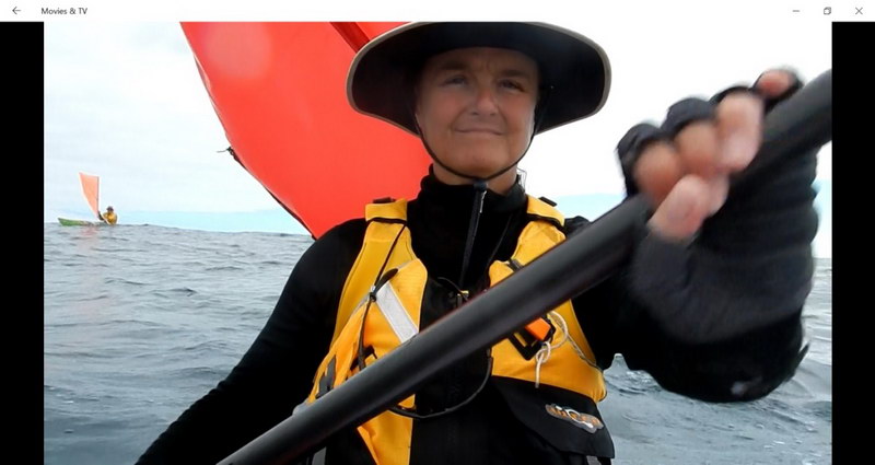
sight! We then had a little wind (approx. 8 knots) but with the front sail
up, my paddling style was altered causing chafing under my arms.
Not comfortable especially with salty water splashing over them! In retrospect,
never having had this before when paddling, I think that with “bulking-up”
for the trip, my thermals were tight under my arms and caused this.
(As an aside, a few weeks before this trip while out with some friends,
I reached over for something across the table and managed to split my favourite
spotty shirt under the R arm – Hulk Hogan-like. I should have realised
then, that my physique had changed! Very feminine – NOT!)
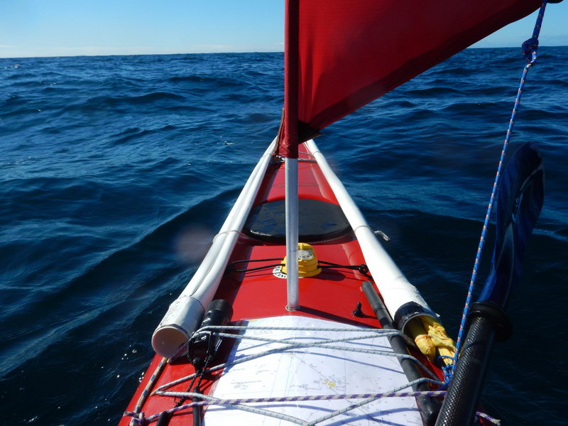
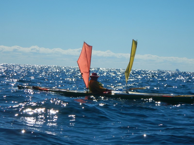
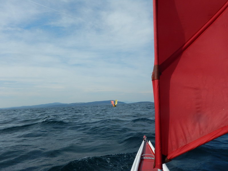
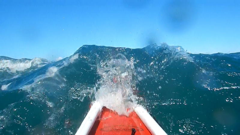
Nearing Hogan Island the wind increased to 15 knots with gusts up to 20 knots and as we tried to head around the northern side of the island, the seas became very steep and were erratically breaking. It became obvious that this was tide against wind and we made very slow progress despite the following wind. At times is appeared that the light house on Hogan was in the exactly same spot! I had my large red sail up and felt that if I tried to take it down, I was going to have a swim, so just kept going. My favourite side for bracing is my LHS but all of the breaking waves were coming from the RHS. Needless to say, I was chuffed that I managed to brace into these waves and not fall in! It would have been rather difficult for a rescue in these seas.
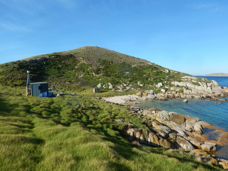
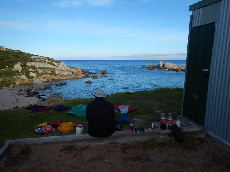
We finally paddled around the NE tip of the island into calm and peaceful seas and landed on a sheltered beach near the hut. I set up my tent next to the hut and Laurie set up his kit inside. After doing so, Laurie went to see if he could find the fresh-water soak and I headed up to the light house for a look back to Wilson’s Promontory and a view to the south. There were heaps of Geese and the grouse flitting out the tussocks managed to give me a few scares! Thanks to those who have redone the hut and left instructions where to find the water – much appreciated!
April 1st - Hogan to Erith Islands
We left Hogan at 0800 with a clear view of our destination. I
had not slept very well due to the honking of geese around the tent during
the night. Also, their “calling-cards” (ie poo) made for tip-toeing
in the morning while packing up! It had been a clear and cold night
with wonderful stars and dew on the tent.
There was not much wind to start with bur from about 1000 we
had a 10-13 knot North westerly wind which made things a tad easier.
On the journey there were lots of Albatross soaring above and around us
– magnificent.
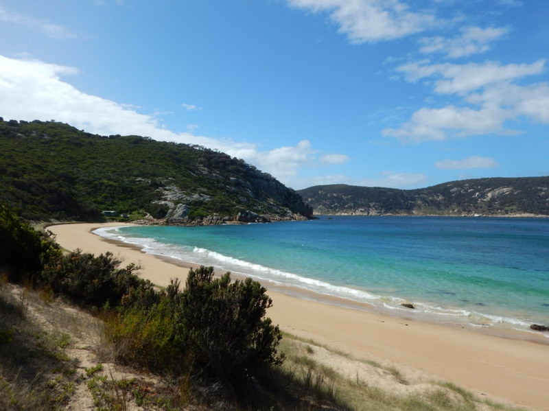
The entrance to Murray passage was glorious with wonderful rock formations and we finally arrived at Bulli Bay Beach after a shorter day than yesterday. However, as it was our 4th day paddling, we were both rather tired. We made camp in the old hut that used to be owned by the Stackhouse family while running cattle on the island. It was an old corrugated iron quintessential shack, complete with 2 beds, a little kitchen and plenty of books to read. The log book made for some interesting reading. I was so chuffed to have arrived here and even more proud of Laurie having completed yet another journey to the Kent group.
Erith Island
April 2nd – Erith Island
After a very lazy start to the day the rest was spend exploring.
OM and I tried to get phone reception above the southern end of the beach
but were unsuccessful. Unfortunately, he hurt one of his Achilles
tendons in the process and was then bossed by me to rest up for the rest
of the day! I walked to the western side of Erith and was greeted by loads
of geese and wild seas – luckily we weren't out there today!
April 3rd – Erith and Deal Islands
With calm seas in the Murray Passage, I decided to go over to Deal
Island and explore. Laurie watched me from Erith to make sure that
I was ok. The tide was quite strong from south to north so when I
finally reached Deal, I had to paddle down the coast to the landing point.
After changing, I wandered up to the Phone Chair where mobile reception
was good and made a few calls. I then went up to the houses to meet
the current care-takers and found Martina collecting “goose-oysters”.
These were goose poos destined to make a slurry for the amazing veggie-patch
complete with tomatoes, capsicums, peas, beetroot and salad. I then
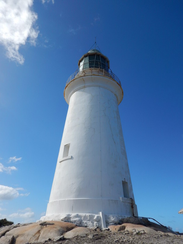
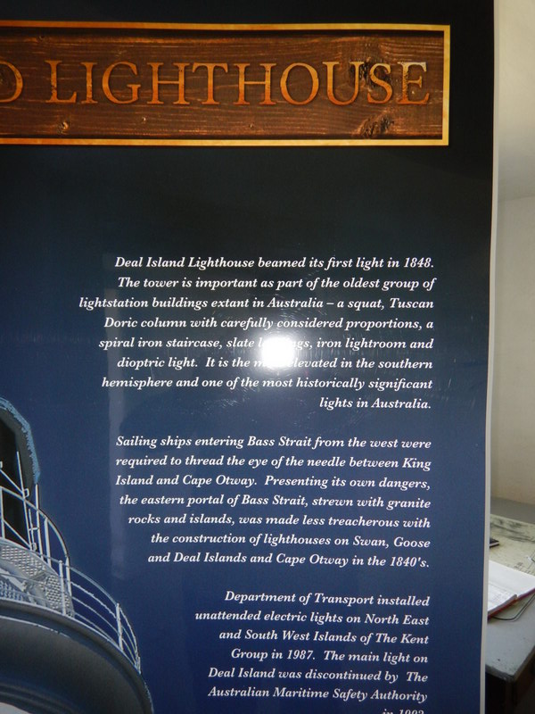
walked up to the light house through glades of Sheoaks (and eucalypts close
to the top) and enjoyed the views and peace. After visiting the museum
on my way back, I had a lovely time chatting to the care-takers over a
cup of coffee and Anzac biscuits.

Deal Island
When about to leave from Deal Island, I radioed Laurie on the VHF to let him know that I was coming. When we arrived down on the beach we were greeted by a very bright strobe-light from Erith. Laurie and I had bought new water-proof torches for this trip, but his was equipped with a strobe light as well. As a result of the light being so easy to see from Kms away, he earned the new nickname of “Flasher- Ford”!!
April 4th – Deal Island to Flinders Island
Up at 0400 and as we were already mostly packed, we were on the water
at 0500 (daylight saving time) – it was pitch dark. Laurie
had on his old hat with blue flashing lights and I had a flashing bicycle
light on my hat. The penguins were noisily leaving their burrows
and made for a noisy farewell. The paddles dipping in the water were
setting off some phosphorescence which was glorious. Heading out
of Murray passage, the tide was obviously with us, as we made rapid progress
around to the SW of the island. It was there that the sun started
to come up and we were greeting by amazing view of the rock formations
on the coast. I came up with a new term for my least favourite conditions
– “crapotis” instead of “clapotis” for the horrible, and nausea producing
backwash off cliffs! Anyway, it wasn't too bad and we cleared Deal
Island in no time.
The flashers were turned off as the dawn broke and in the distance we could see Wrights Rock, Craggy and Flinders Islands. The day then turned into a bit of a slog – no wind assistance and a destination that just didn't seem to get any closer!
Nearing Wright Rock after 4 hours of paddling, we saw a Willy Wagtail
flying around – goodness knows what it was doing out there!
It was another 3 hours to Craggy Island – if there had been somewhere
to land and stretch, I am sure that we would have done so, but there wasn't.
Another 4 hours to Killiecrankie and despite the glorious views of Albatross
and Gannets we were 2 weary people who hauled their boats up the beach
and made camp. Laurie had his usual “pick-up meal” of Saos and Spam
and I had a rather large curry. Bed before 8pm.
April 5th - Killiecrankie to Whitemark, Flinders Island
I had a visitor to my tent at 0300. Not a rodent but OM.
Like old times, he had recovered fully from the day before, had listened
to the weather forecast for that day, and said that we were leaving at
0730! There was a window of opportunity before the bad weather arrived
and this was our chance to get to Whitemark.
So, we headed off – sails up to Cape Frankland. In 20 years I
haven’t been game to put up both sails in windy conditions, but decided
that this was the day! We sped along to the cape in 1.5 hours and
then turned down the coast. On this part of Flinders it is very rugged
and with densely covered slopes and a few new, large houses tucked away.
We stopped near Royden Island for me to address my underarm chafing again.
Across Marshall Bay the wind speed started at about 10-15 knots and then
increased to 20 knots past Settlement Cove (with gusts up to 25 knots).
We then had a wild ride to Long Point. At times, I must admit that
I was totally out of control and was tearing along at high speed with the
nose of the kayak burying itself into the wave in front. However,
it was exhilarating and looking at OM, I knew that he was having a ball
as well! At times, he was impossible to keep up with!
We then turned at Blue Rocks to run up the point and had slightly more
control with the wind off to the side. A lone Wind surfer appeared
to be having fun in the same conditions. We arrived in Whitemark
8 hours later - changed and staggered up to the Bakery (via the hospital
to get some more dressings for my chafing) while OM booked into the pub
for a couple of nights R&R. Unfortunately after filling
up at the bakery, neither of us could finish the enormous “chicken Parmis”
at the pub and were in bed early as usual!
No wonder we were tired – 125km paddling and 19 hours in the kayaks
in 2 days!
April 6th – rest day Whitemark
After a slow start to the day went to Freckles for breakfast – Ham/Cheese
and Tomato toasties. One for me and 4 for OM! Visited Dawn
to look at her wonderful paintings of the Furneaux Islands and did some
restocking for the paddle ahead. We visited the bakery again in the
arvo before settling for Ched biscuits and Cup of Soups for dinner.
April 7th – Whitemark to Ned’s Point
After visiting Dawn to order a painting of Goose Island, and watching
a barge deliver blue-metal for a new airport runway, we left at 1140.
The wind was light westerly. Before long OM had to stop to do some running
repairs on one of his sails – I took the opportunity to watch a flock of
Oystercatchers. Near Trousers Point the wind strengthened and I so
took down my back sail. It increased further to 20-24 knots and I
battled to keep up with OM who had both sails up. It became obvious
the closer we got to Long Island, that we were going to be swept east with
the wind and tide and so made the decision to stay at Ned’s Point.
Unfortunately we overshot this by approx. 3 km and had to paddle back into
a headwind. We landed at about 1600 and made camp and had another
small campfire.
April 8th Ned’s Point to Preservation Island
Left at 0845 and took just under 2 hours into a light head-wind to
Old Township Cove – this was made much easier with an incoming tide.
OM mended his battery wire and we relaxed till midday and high water.
Then it was around Cape St John with lumpy/bouncy seas. The smaller
points had submerged rocks causing breaking waves that needed dodging and
as a result, I had a few “Singer sewing Machine” knee moments! The
winds were westerly and about 20 knots with the waves 1-2 metres.
I definitely had more practice bracing into my least favourite right side!
There was a brief lull at Key Island and the wind increased again as
we headed across to Preservation Island. At times I was tempted to
change from my larger red sail to the smaller yellow one, but glad in retrospect
that I didn’t. It was great to arrive there again and settle in –
many thanks to the owners of this hut who allow people like us to use this
facility!
April 9th – Preservation Island
Another early wakening at 0300! OM having a belated midnight
feast of Saos and peanut butter and then another new plan!!!!!!!! We might
be able to leave on 11th/12th April……………
Then woke at 0630 and relaxed with a strong NW wind buffeting the hut.
Late morning I went for a walk to the NW of the island. All the beaches
had a lot of drift wood and cuttle shells. There were lots of Geese
in pairs honking at being disturbed.
On my way back from the walk (after seeing lots of cow manure and wondering where they were) I was suddenly surrounded by 20-30 of rather large steers and took shelter behind a thorn bush. They didn’t appear to be very friendly and were practising head butting each other! They kept coming closer and closer and I was worried that after crossing Bass Strait I was about to be trampled by the “killer cows of Preservation Island”! Finally I plucked up courage to leave my bush and headed back to the hut without a problem. Upon arrival was told by OM that;
1. He would have sent out a search party (ie him) if I wasn’t back by
10pm – mmmm – reassuring, and
2. The cattle were just ultra-inquisitive and if I had just sat there,
they would have licked me! Apparently the same thing had happened to him
and Elli many years ago!
Had a relaxing rest of day reading Nevil Shute. Then snoozed –
woke when I fell out of my boat for the first and only time this trip!
Lots of pelicans in the bay that evening – beautiful!
April 10th – Preservation Island
Another rest day due to the weather. This time walked to the
southern end of the island and marvelled at the huge seas and wind.
Saw a rather large snake going into the mutton bird burrows and after filming
it for a while, decided not to continue as it appeared to have taken an
interest in me! There were lots of skeletons of penguins, geese and mutton
birds – not sure if there are Tassie Devils on the island??
April 11th – Preservation Island to Little Musselroe Bay
We left Preservation at 0500 in the dark heading for Rebecca Bay –
the tide was outgoing so was going to help us around Clarke Island.
After getting around Rum Island with the aid of our spotlights, the seas
and wind were larger that we envisaged which made for interesting paddling.
I am not sure that I really like the sound of waves breaking around me
when I can’t see them! I must admit that my stomach didn’t feel great for
this paddle!
Luckily there was enough light by the time we were heading around the rocky points of Clarke Island as the seas were very unpredictable and lumpy. I decided that despite being a tad nervous, I was enjoying the challenge of the seas and felt very stable and confident in my kayak! We finally got into the sheltered waters of Rebecca Bay, got changed and waited for the change in tide for our final leg to Little Musselroe Bay.
I rang Garth from Rebecca and was questioned as to how the morning went
– I replied “terrifying” which obviously wasn’t what he wanted to hear!
I tried to explain that I had meant “awesome” but I am not sure that he
understood! We were so close now to getting home, that I shouldn’t
have worried the poor bloke!
We left at 1100 and OM helped me get out through the surf unscathed.
Unfortunately he copped a few waves and needed a 10 minutes to sponge out
his boat before we could venture on. It was then an interesting paddle
through the tide race off Rebecca Bay before settling in to the stretch
to LMB.
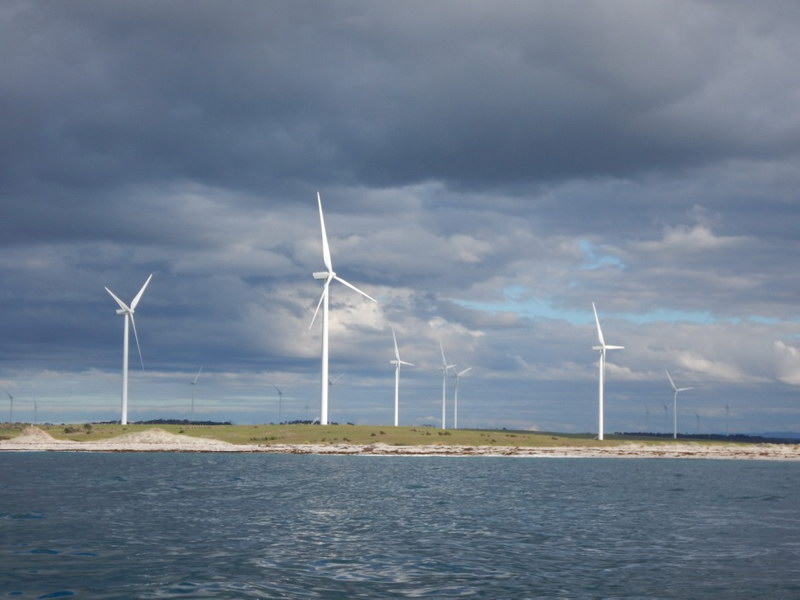
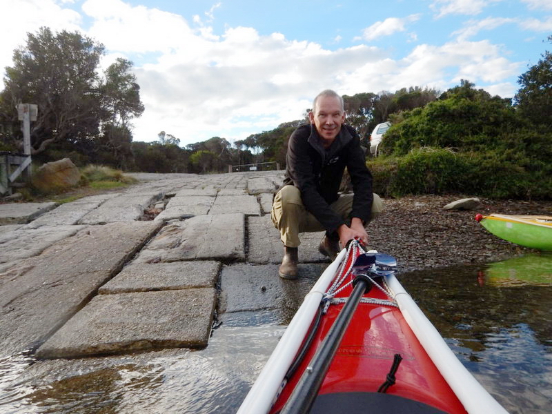
We arrived at the coast just as the tide was turning and then paddled east (with the current) to our destination. Despite the forecast of some wind, the large Hydro Wind towers were not generating much at all. We were greeting by Garth at the boat ramp bearing cider and egg and bacon pies – mmmmmmmmmmmm
Liz Ponting (and one of her neighbours) came to say hello – both OM
and I were relieved that her husband who had recently been very ill, had
made a miraculous recovery.
It was then the long drive to drop off OM at Dodges Ferry and then
home.
A fantastic adventure with an inspirational friend Laurie Ford – thank you for everything!!!