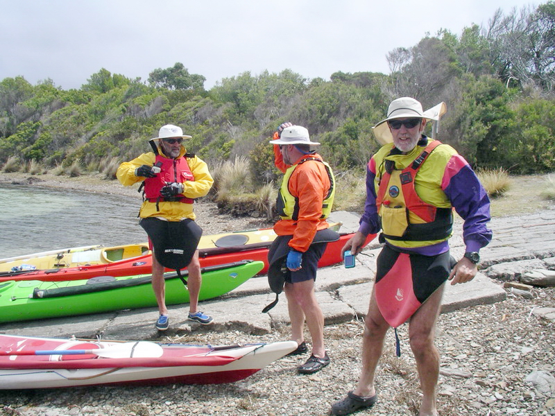
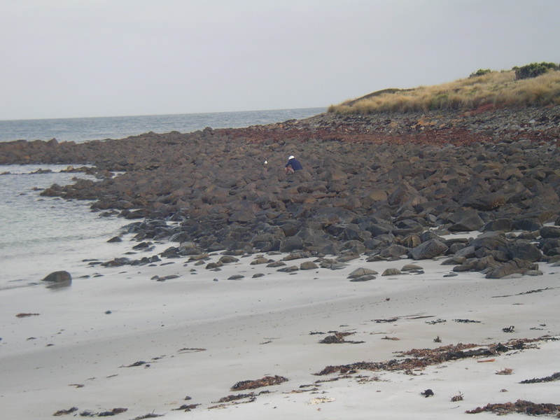
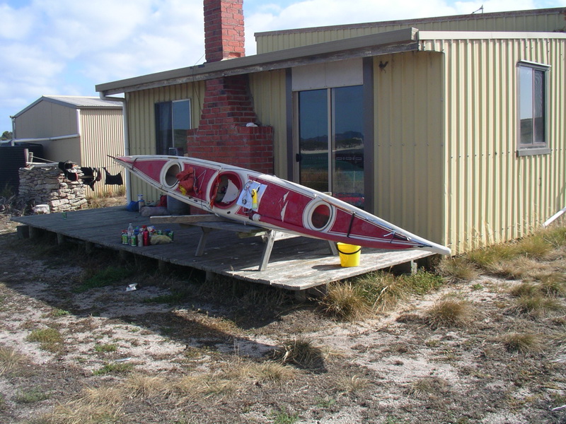
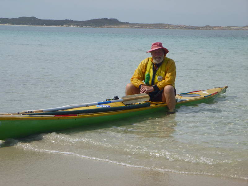
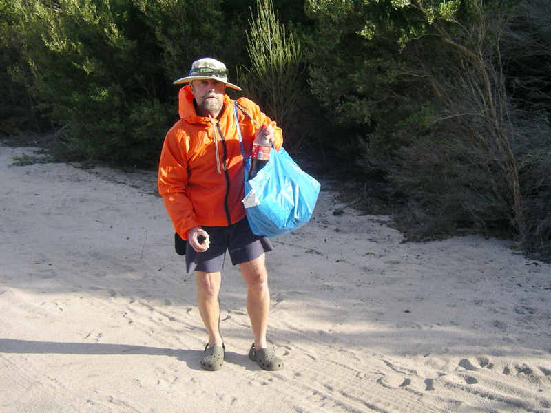
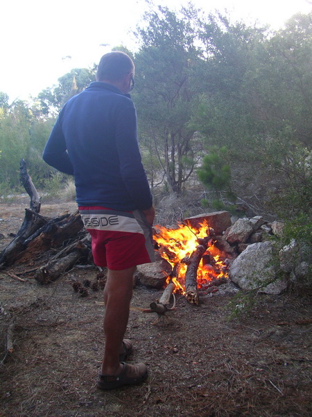
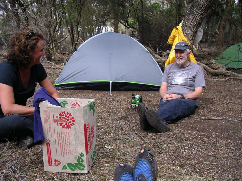
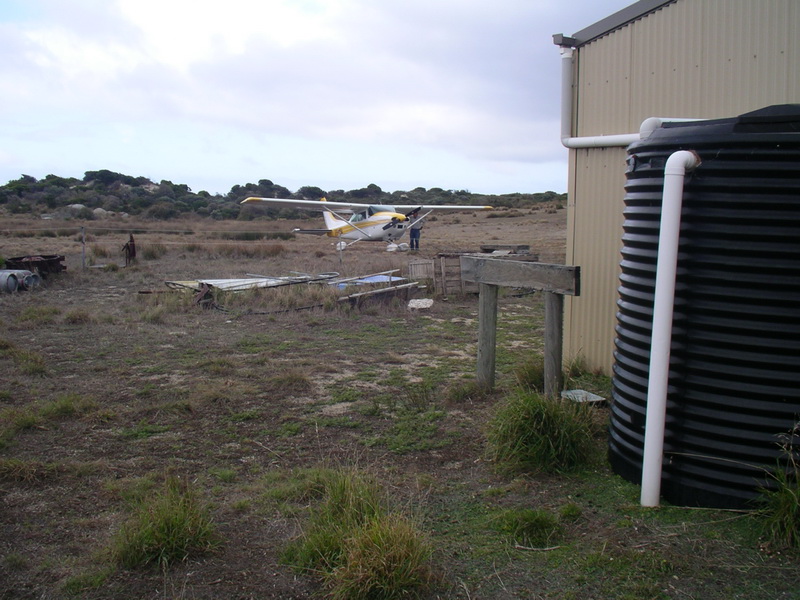
Little Musselroe Bay
(BOBS was coined by Sue to stand for Bearded Old BlokeS, but some people you talk to suggest it is for Bearded Old BastardS.)
This is the report written by John Lawler, one of the first timers. Photos by Laurie unless otherwise noted.
FLINDERS ISLAND TRIP, FEB 2015
(The liquorice allsort trip – a bit of everything)
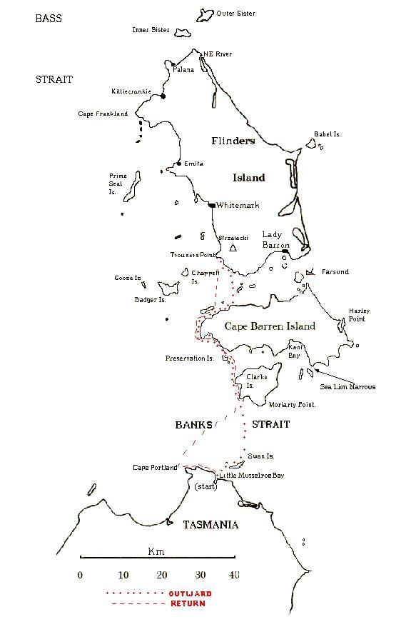
(map)
PICTURE this: four grey-bearded old bastards paddling their sea kayaks
from Tasmania’s north-east to Flinders Island across one of the world’s
most dangerous waterways – Banks Strait – and back.
That was the plan initially proposed by our fearless leader, Laurie
Ford (AKA Capt Grumpy, or Lawrence of Tasmania) for February 2014, but
the two novices of the group Richard Hawson and John Lawler cried off,
fearing they were not up to scratch then for such a daunting mission.
Determined bugger Laurie kept us training through 2014 with little
day trips around the Derwent River, lessons in support strokes and then
a preparatory weekend trip to Maria Island across Mercury Passage – so
the prospects of a big trip were looking good, damn it.
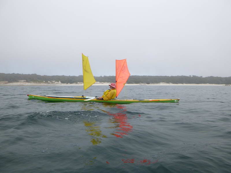
Kayaks were modified, sails were altered and we had become somewhat
expert at capsizing, some more expert than others judging by their amount
of watery dramas. Before we knew it 2014 had flown by and the Flinders
threat loomed as a reality.
D-day was Sunday February 8, leaving from Little Musselroe Bay. The
die was cast, the movable schedule finalised and the reassuring words from
our leader bolstered our confidence: “These tides are the best you’ll ever
get in February.
“Some of the distances may seem long (33km tops), but keep in mind
there is really good tide assistance in a lot of places.”
It was all planned with military precision. Tides, currents, winds,
low pressure and high pressure systems studied. We were ready, weren't
we? No risks to be taken, just a gentle island-hopping exercise in the
summer paradise of Flinders Island. What could go wrong?
Read on at your own peril.
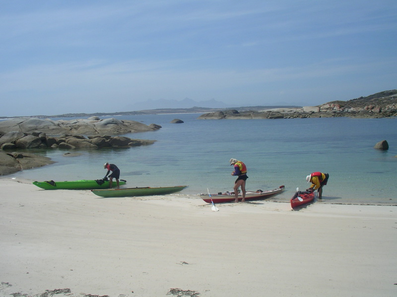
DAY 1: The newly dubbed four Bearded Old Bastards, or BOBs, courtesy of injured Flinders scratching Sue Shearman, gathered at Little Musselroe lagoon boat ramp about 1pm. Leader Laurie and Launceston member Toby Clark, the other experienced hand, had arrived early and were almost set to go.
Little Musselroe Bay
Richard and I, the novice Hobart duo, had been detained slightly after
calling in to the Bridport Hotel for essential supplies. I discovered a
scouting mate from 45 years ago was running the pub, so a quick catch-up
and beer were mandatory! What a good start.
We packed our boats, donned the kayaking clobber, smeared on the sun
creams and set off at 2.30pm in mild temperatures, punching into a moderate
north easterly and heading for our first camping stop-over, Swan Island
– just 8km off the coast, a doddle.
Crossing to Swan Island as the wind decreased
Veering around the western side towards the lighthouse, a slight change of plan because of the north easterly, we found a nice sandy beach to come ashore near the island air strip and discovered a washed-up sit-on kayak. Toby and I emptied it of water and sand and took it for a spin in the beach shallows, vowing to grab it on our return and tow it home.
There was no-one living on Swan Island but this sit-on was on the beach
at the end of the airstrip where we landed
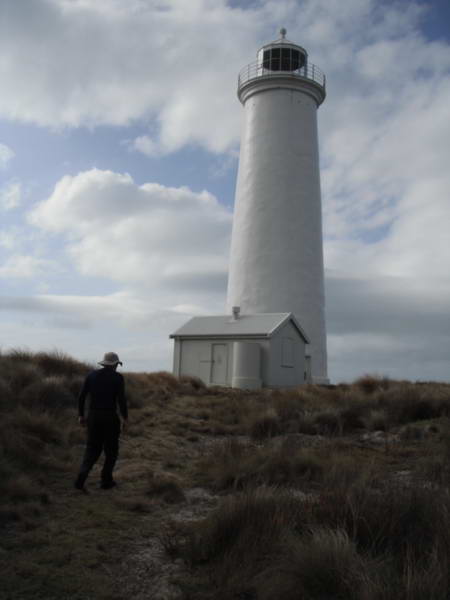
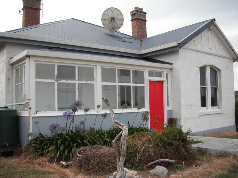
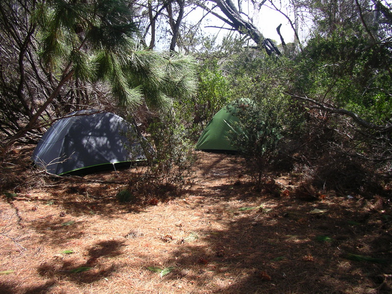
Laurie pitched his fly on the beach and Richard and I found spots for our tents above high tide while Toby chose a spot close to the air strip. Went for a walk along the airstrip to the lighthouse and lighthouse keeper’s quarters but found no-one at home.
 The
Swan Island light (Richard's photo)
The
Swan Island light (Richard's photo)
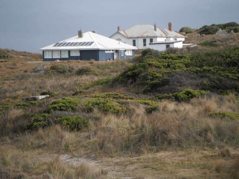 Residences
(Richard's photo)
Residences
(Richard's photo)
 (Richard's
photo)
(Richard's
photo)
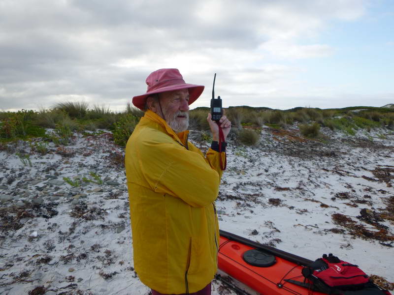 Getting
a forecast (Toby's photo)
Getting
a forecast (Toby's photo)
Back to camp for first night steak and pasta around the campfire before early bed about 9.30pm to build up our strength for the Banks Strait crossing and 30km haul to Preservation Island. So far so good.
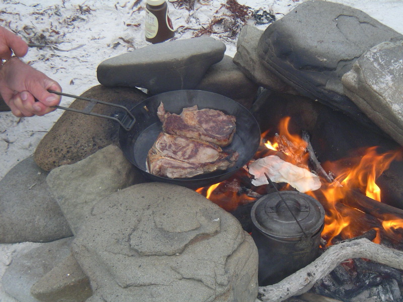
John & Richard's steaks
DAY 2: Swan Island to Preservation Island.
Richard solved the problem of finding a good morning evacuation spot
by jamming himself between shoreline rocks to give himself a wonderful
water view. The view to the rest of us was less wonderful, nonetheless
a man’s got to do ……… and the big challenge was ahead of us – Banks Strait,
no place for toilet breaks.
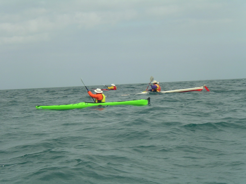
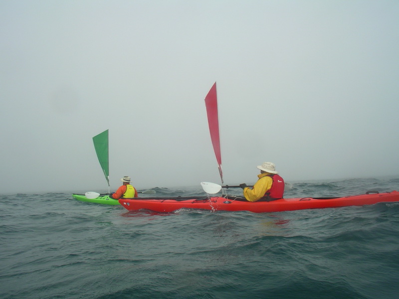
Struck out at 8.30am, sails up around the eastern point of Swan Island and into it seriously. The very fresh easterly combined with 1.5 to 2m waves and a confused sea to test the novice skills of Richard and myself to the limits. Just keeping upright was a full-time job of concentration, frequent support strokes and stamina.
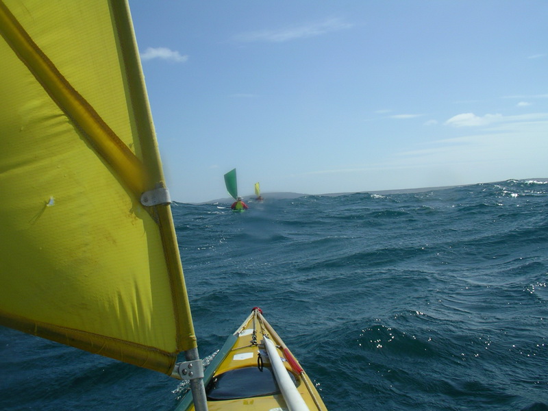
Banks Strait
Think I developed the tightest bum cheeks on the planet and was far
too petrified to attempt taking down the sail – it was just a matter of
paddle on, hold on and keep our leader in sight so as to stay on course,
magnetic north. But that was easier said than done when the size of the
waves kept hiding other party members in the troughs, and our boats (Richard’s
and mine) were proving difficult to steer – sliding down the wave face
and then yawing – because our rudders were not strong enough to take the
force and hold a straight course. Much energy was spent correcting and
cursing before the next wave crashed in. It was about that time I decided
Laurie must surely be a terrorist, for I was truly terrorised!
Three and a half hours later, the last half hour battling the current
too, we completed one very nerve-racking conquest of Banks Strait.
Pulling into a protected hidden cove among imposing granite rocks on
the northern end of Spike Bay on Clarke Island the beauty of the scene
was breath-taking, but the relief was greater. Captain Grumpy shook our
hands and offered congratulations but the sense of achievement hadn't quite
kicked in then. I think he was more relieved than us (Richard and I) that
we had made it. Even the seasoned Toby recognised it had been a tough one.
I think we qualified for our sea kayaking badges right there.
Thankfully, humour was never far away. Laurie, of all people, fell
out of his boat when coming ashore for the lunch break and it was just
lucky I was close enough behind to witness it and record it as the official
trip scribe – pity no Go-Pro on board.
One hour lunch stop near Foaming Point, Clarke Island
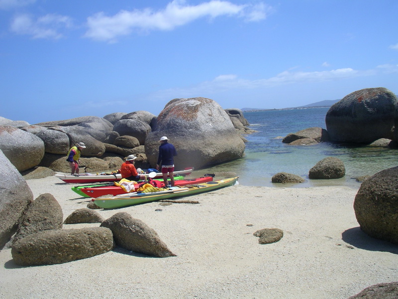
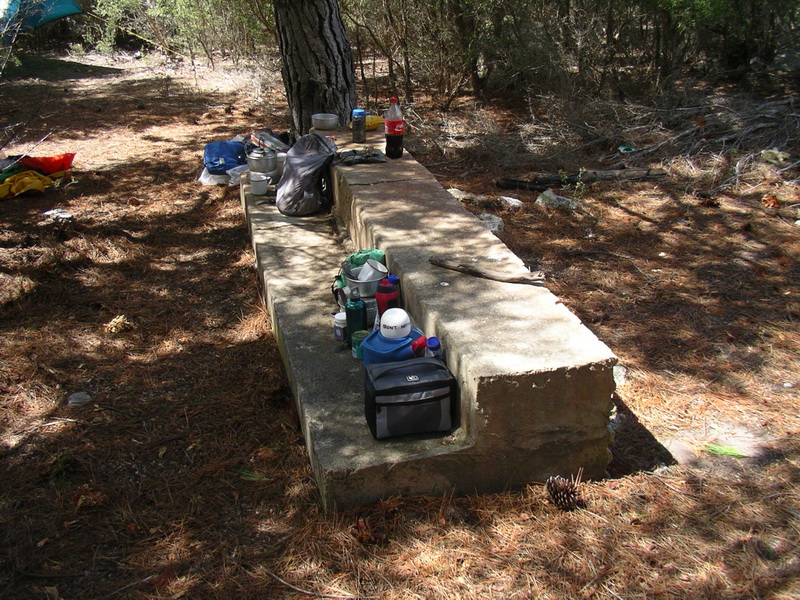
After our well-deserved one-hour lunch break we pressed on to Preservation Island in a moderate easterly but the sailing continued to be difficult with dodgy rudder response. Made it in just over an hour at 2.15pm and were pleased to embrace the comforts of the island shack, which Toby’s connections had offered us – beds, water, real toilet, cold shower and rooms to spare.
Preservation Island
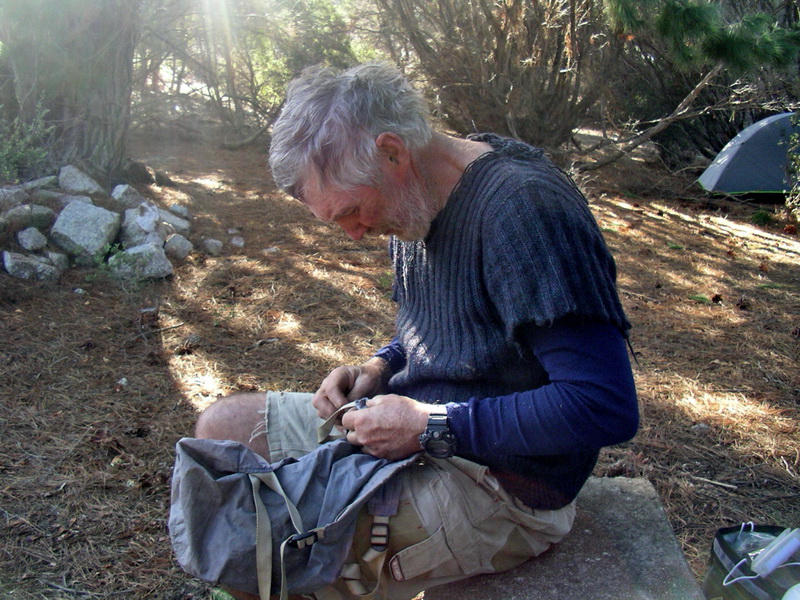
With two days recovery on the island decided when the winds picked up too much for paddling it gave Laurie time to work on Toby’s leaking boat and seal the seams with duct tape. It had been in storage and hadn't had a serious workout for some years, a bit like its owner the likeable Launceston plumber ever ready with a quip, a yarn or a piece of homegrown philosophy.
Checking Toby's kayak for leaks
Toby took us on a trek to the southern end of the island and the wreck site of the Sydney Cove, the huge signal fire place the survivors had made out of granite rocks atop an outcrop during their long isolation in 1797, and idyllic “honeymoon bays” with tranquil waters and white sands amid the granite towers.
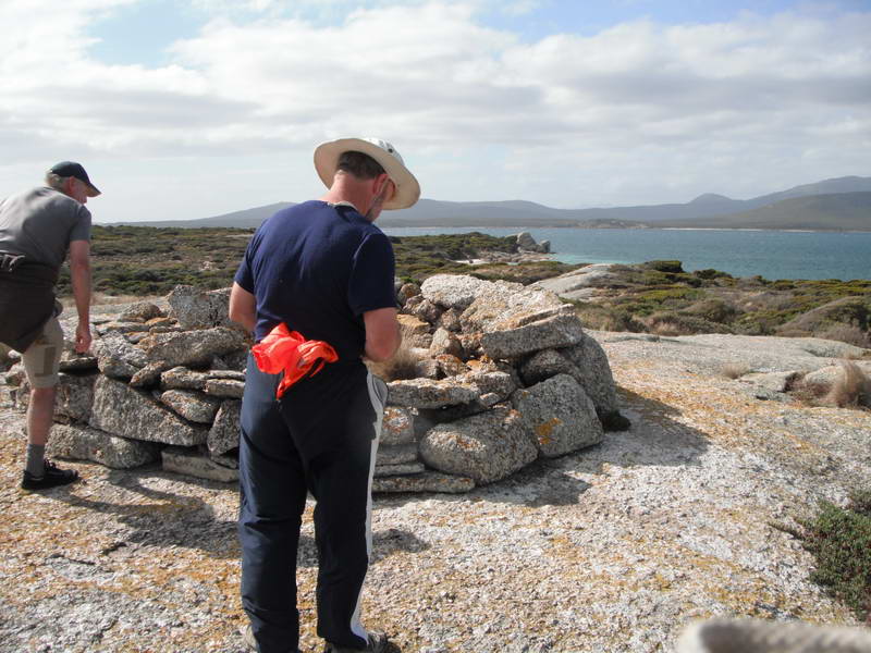 The
old signal fire (Richard's photo)
The
old signal fire (Richard's photo)
 (Richard's
photo)
(Richard's
photo)
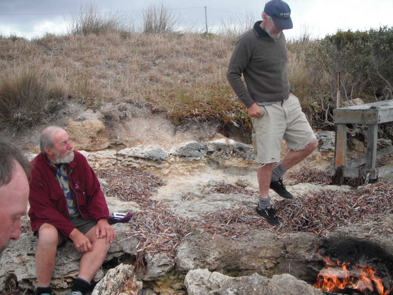
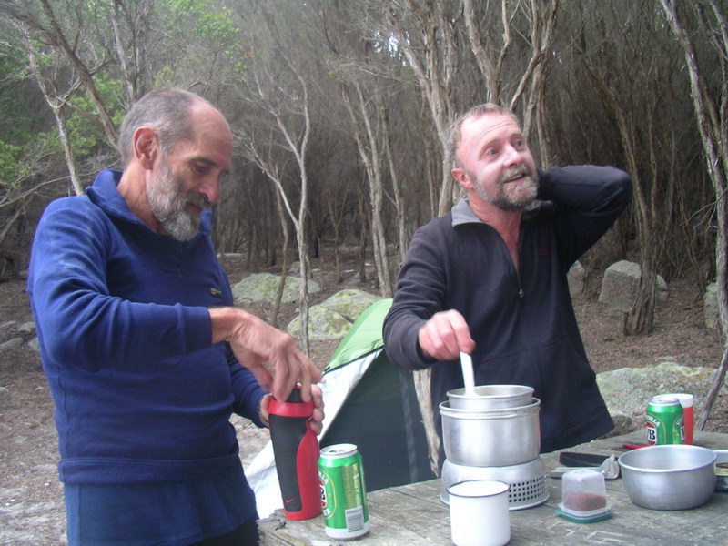
Returned for steak tea, a few of Toby’s load-lightening warm VBs and bed. Buggered but couldn't sleep, regardless of the ceiling tap dancing capers of mice and rats.
DAY 3: Preservation Island.
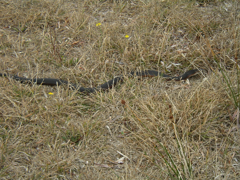
Easterly winds eased but Laurie decided to relax his charges another
day. Shock meeting with two copperhead snakes about a metre long heading
for Laurie’s boat. I reckon they were really after his cheesy biscuits,
couldn't be the Coke! While Laurie fended off (antagonised) one snake with
his paddle another joined the fray. Eventually the bigger one slithered
off, unimpressed by Laurie’s snake charms, and the other hid under the
wood heap near the shack and the clothes line – marvellous. On a later
walk Richard and I encountered a third snake.
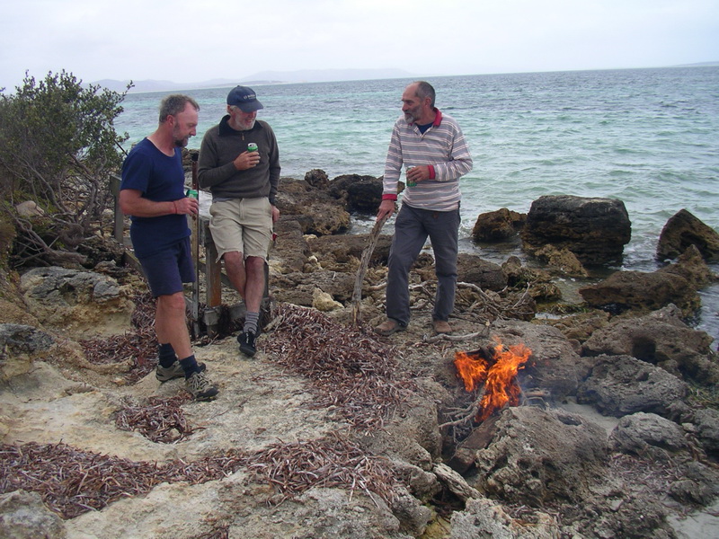
Toby’s rubbish-rid fire on the rocks turned into an extended happy hour, although Richard wasn't too happy with the spark that caught him on the eyelid and left him with a sore point for days.
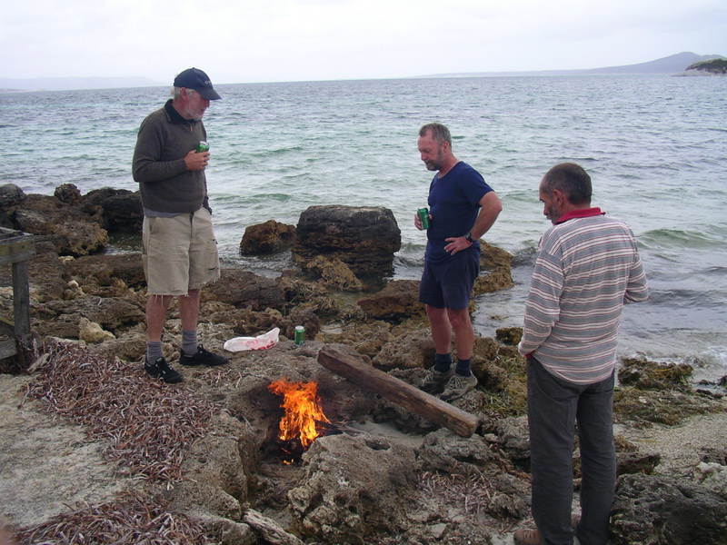
Happy hour
 (Richard's
photo)
(Richard's
photo)
DAY 4: Preservation Island to Ned’s Point, Cape Barren Island.
Set off in light winds and sunny conditions, for a change, and headed
for Thunder and Lightning Bay on the south-west shores of Cape Barren Island
with plans of finding a secret camp site there that Laurie had used before,
and a fresh water source that bubbles to the surface just above high water
mark.
Despite the calm conditions I had no energy and made hard work of the paddle, feeling stuffed by the time we came ashore for a break at Thunder and Lightning. I realised the headache and lack of energy were the effects of dehydration so a couple of neurofen and a long drink did the trick. While I rested the others scouted for the secret camp site, met the locals – Jim and James Everett collecting abalone around the rocks – located the water source and went for a skinny dip. Laurie refilled my water bottle from the spring, and it tasted really good.
 Laurie
(Toby's photo)
Laurie
(Toby's photo)
Thunder & Lightning Bay
Somewhat recovered, we set off to round Cape St John and a lunch break
at Old Settlement Cove, a glorious niche in the boulder coastline. Feeling
even better after lunch, we headed to Cape Barren township for Laurie’s
much touted National pies and a drink from the shop. We arrived to find
a power cut and the shop closed but a very obliging community centre manager
(Denise) said the shop operator would return soon and open up for us if
asked nicely. She did and we bought frozen pies (not National) and drinks,
and the centre manager let us heat them up in her office microwave.
While the pies heated Richard connected with “the brothers” and found
out we were already expected on Flinders Island by the service station
operator. News travels fast when the BOBs are on a mission.
After pies and drinks my recovery was complete and it was on to Ned’s
Point, just around the corner, to check out a good camp site.
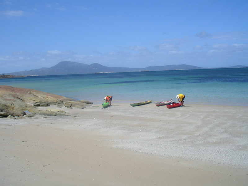
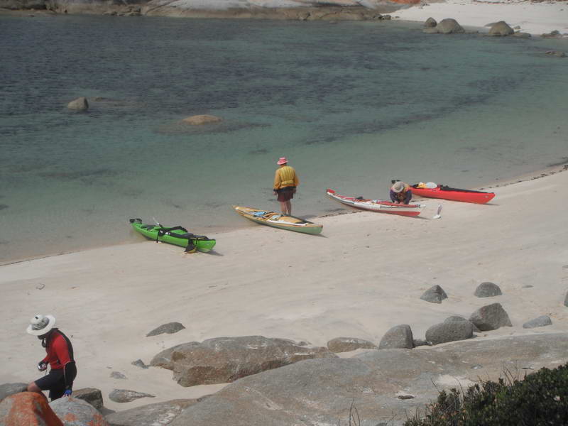
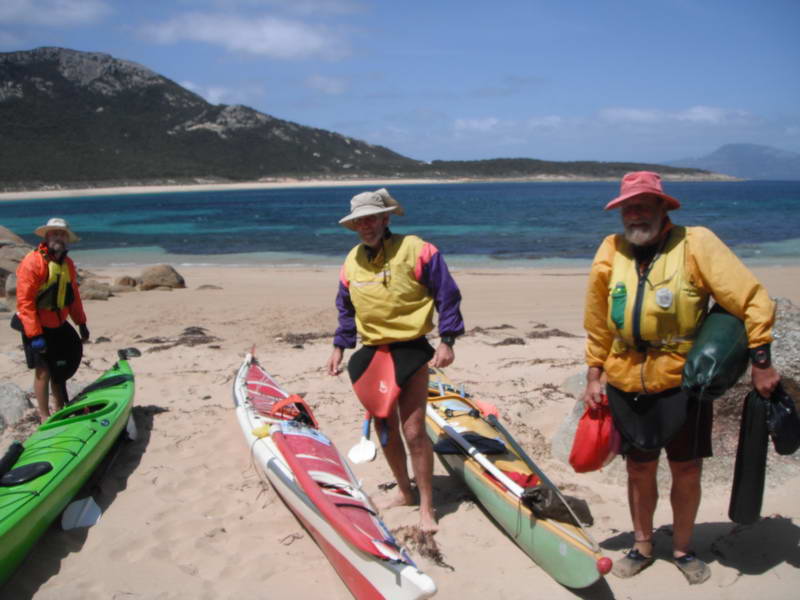
From front to back: The Longboat, a Greenlander,
then 2 plastic Seabird Expeditions.
 The
Longboat (Toby's photo)
The
Longboat (Toby's photo)

DAY 5: Ned’s Point, Cape Barren Island.
Stranded by strong easterly winds of up to 40 knots, we were prevented
from progressing along the Franklin Sound to the Farsund wreck, Great Dog
Island and on to Lady Barron on Flinders Island as planned. The winds forced
us to move from the initial camp spot, just around the point, to the old
farmhouse camp site just along the track where it was much more sheltered
among the big radiata pines, giving Laurie the chance to repair his ripped
fly which had succumbed in the early hours. We left boats at first camp
and took what we needed to new site, a short walk away.
While Laurie the “Coke trafficker” had his needles out brushing up
his sewing skills on his torn fly, Toby caught the bug and decided to repair
his much loved but dilapidated day pack. But his rusty needles were not
up to the task so soon a needle exchange was happening, in broad daylight
brazen as you like.
Still the strong east/south easterly blew. Toby, Richard and I started
a walk to the Farsund down the coast but it was too far, and anyway we
first needed to determine what year it foundered, a contentious point for
some.
Returned to camp for a rest and Laurie decided it would be worth having
a shot at getting to Trousers Point on Flinders in the morning with a proposed
10am start. So it was fire, baked beans and bed.
DAY 6: Ned’s Point to Flinders Island.
With Flinders Island the big objective we took off at 9.30am to take
advantage of a window of opportunity – more like a louvre really – in the
slightly improved windy weather. It was a dash with a distinct degree of
difficulty as we battled into a 25knot easterly and “just little waves”,
according to Capt Grumpy, to get clear of the point and fight the wind
for a while before getting some tidal assistance to pass Anderson Island.
Richard got caught side on to the waves and had some trouble getting around
again to join the battle.
Eventually reached Flinders shoreline and had a short break at “This Beach”, just west of Buffalo Beach, where a beached runabout with motor attached provided a real temptation to a weary paddler. Satan, get thee behind me!
 (Richard's
photo)
(Richard's
photo)
Time for drinks and jelly beans – addicts had Coke – and we forged on to Trousers Point, hugging the shoreline in relatively easy wind conditions, except for the odd unexpected squall. Our fearless leader had set sail with the words: “You’re on your own to Trousers Point”. Fatal words on Friday the 13th I thought.
Sure enough, a tricky windshift caught Richard off guard not long after
we had left the beach and he became the Friday 13th capsize victim. As
he was bringing up the rear and some distance behind it was lucky I heard
his call for help, and Toby and I paddled back to make a textbook rescue
– not. While I was trying to lift the nose of Richard’s boat to empty the
cockpit before righting it, Toby was turning it straight over mistakenly
thinking it had an onboard pump. After a short wrestle we got it upright
and Richard clambered in and began sponging out. Toby realised the no-pump
scenario so we paddled ashore to empty out and resume the trip, just as
Capt Grumpy came back around the point looking for us. “Just a training
exercise,” Toby explained.
Pressed on for a short stint to Trousers Point, landed with relief
and raised the flag (sail) – mission achieved – and promptly broke it.
But there was a certain feeling of TCFT – thank Christ for that!!
We lifted the boats up high on the shore, found a protected camp spot
and got set for a few days of adverse weather bringing high winds and rain.
Met the ranger, who Richard knew, and he agreed to phone Sue to tell her
where we were camped. She had flown in earlier and hired a car for a few
days’ touring around. Sue arrived bearing gifts of cold beer and chips
which were gratefully accepted – even Capt Grumpy had a cider or two.
 (Richard's
photo)
(Richard's
photo)
Richard and I walked to Fotheringate Beach, another beautiful spot, dined on Irish stew (canned) and retired early and exhausted. Rained hard in the night and my $20 tent only leaked very slightly. Next day planned to explore some of our unattainable stopovers with the use of Sue’s hire car.
That was Friday 13th – phew, dodged a bullet there.
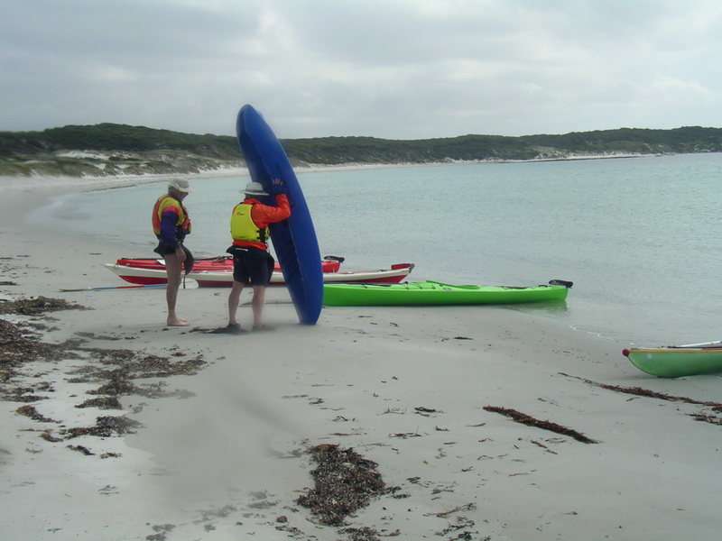
DAY 7: Trousers Point.
Woke to morning cuppa call from the ever reliable Toby, who had put
up a storm fly after the heavy overnight rain and thunder and had the kettle
on the boil.
First stop Whitemark for coffee and a bite at the bakery, but it was
shut. Found Freckles café opposite a popular and busy spot filled
with tourists, and bedraggled kayakers – us. Hunger satisfied it
was on to Lady Barron and Vinegar Hill to gaze out on Vansittart Is and
points on the original schedule we had been unable to reach.

Amid the persistent showers we checked out Yellow Beach camp site and
Furneaux Tavern, which seemed shut, so it was back to the Whitemark pub
(Interstate Hotel) for a few relaxants and booked in for dinner – Richard’s
shout! Returned to soggy camp for pre-dinner nap.
After an enjoyable dinner we endured a horrendous night with fierce
winds howling above as the stormy front surged through, trees fell and
Laurie’s fly ripped, again. Torches came out from the storm-lashed campers
to check for damage when a tree was heard crashing heavily in the night
– just a couple of metres from Laurie’s camp spot – but the other tents
held up well in our relatively protected hollow and escaped any further
tree trauma. So this was the promised summer paradise of Flinders Island
– turquoise waters, pure white quartz beaches among orange lichen-coated
boulders, easy shoreline paddling and island hopping in the warm sun-filled
days!

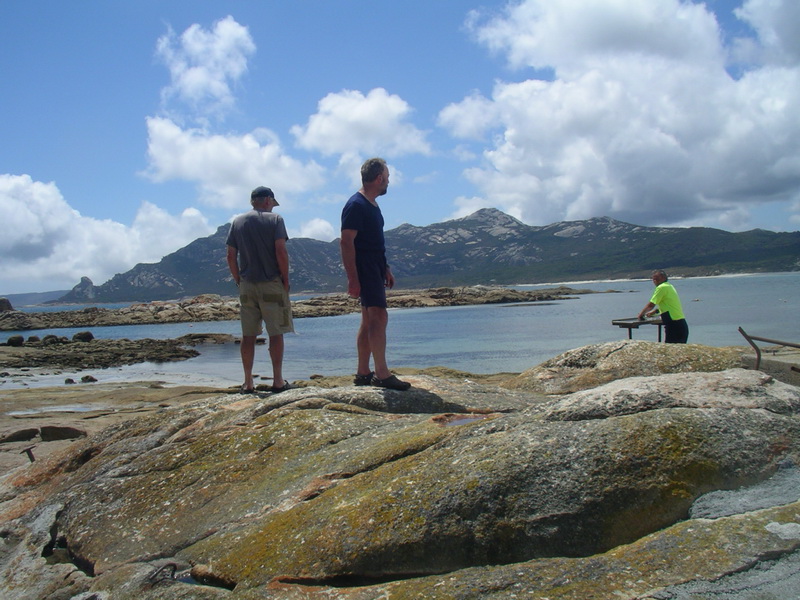
The postcard image was having great difficulty living up to its reputation with the cloud-shrouded peaks of the Strzelecki Range brooding gloomily over us. Luckily we had Sue’s car for exploration purposes, and no shortage of good company and humour.
DAY 8: Trousers Point.
It was a subdued breakfast after the shocking night, but with Sue’s
car at our disposal we set off to do the tourist bit again. First to the
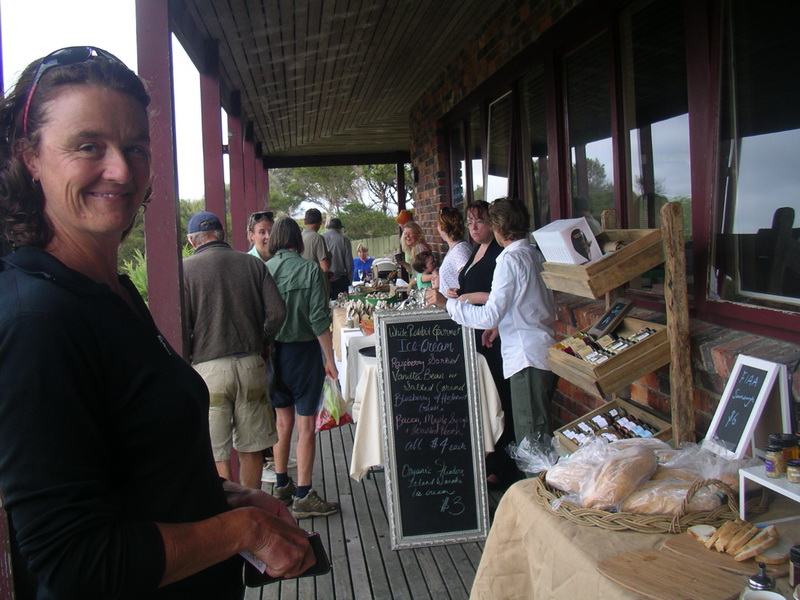
farmers’ market at Lady Barron which was arranged around the front verandah
of the Furneaux Tavern. A poor reflection on the island farmers, according
to Laurie, because there was only one farm-produce stall amid the souvenirs,
island water, coffee and German sausage offerings … tisk, tisk, hmmmph!
Then north to Allports Beach near Emitta to find another lovely beach and campsite, on the old tennis court once part of the Allport family property, where we would have been quite comfortable had we been able to make it in favourable weather conditions.
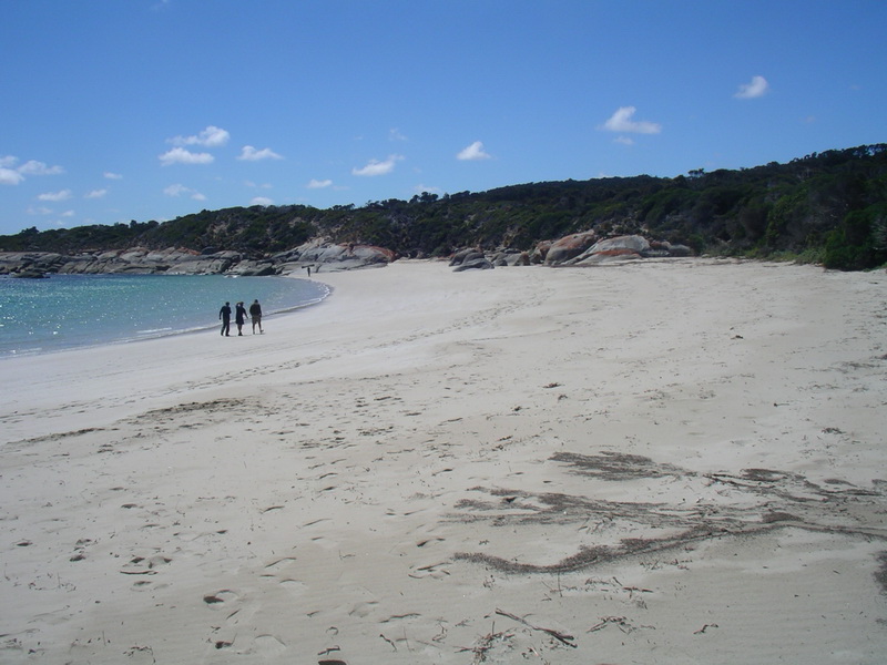
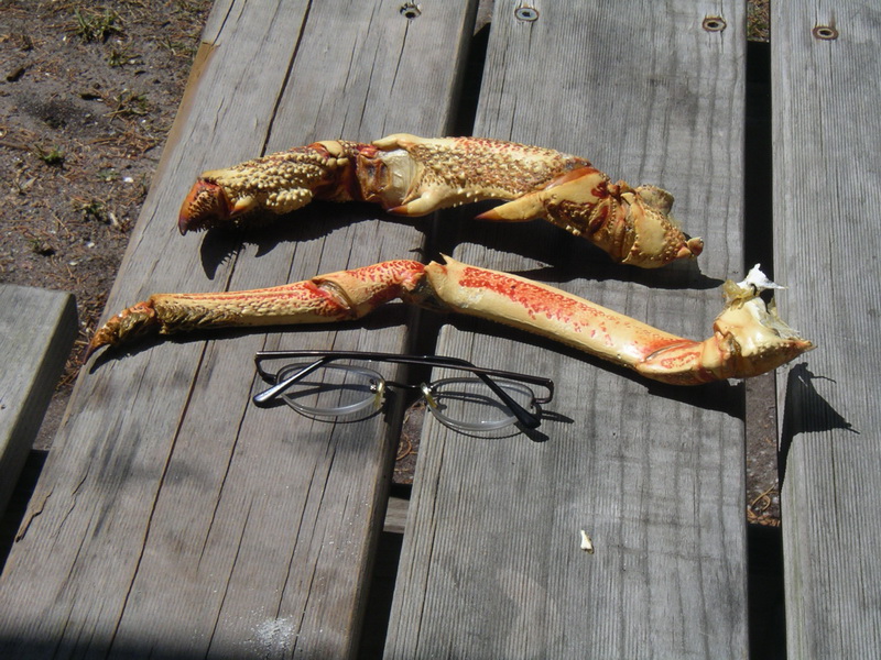
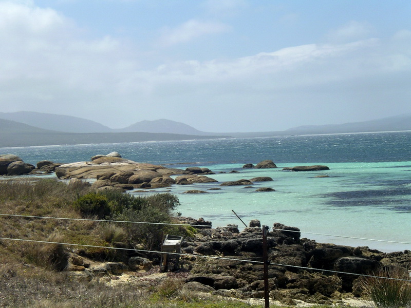
Further north to Killiecrankie and its beautiful beach, which was basking in hot sun when we arrived and began to chat to a bloke cleaning fish on the rocks. After a few minutes he looked up and recognised Toby, a fellow plumber, and then Richard and I realised we also knew him – Derrick Wills – from different connections. Small world, even at the Tassie extremities. Derrick showed us some collected Killiecrankie diamonds and a pair of enormous crayfish claws, but unfortunately nothing in a takeaway form.
Retraced our steps to visit the Flinders Island Museum near Allports
Beach and take in the island history: early cottage industry of muttonbird
trade with its heavy involvement of our indigenous cousins, soldier settlement
days, island school and hospital, and the various shipping wreck stories.
A very impressive collection and display of island history and life.
Back to Whitemark pub for a few pre-dinner drinks and then returned
to Trousers Point camp. Had a skinny dip, purely for freshen-up purposes,
dined on Irish stew, and retired with the plan of heading back to Preservation
Island at 8am – the start of our return leg.
DAY 9: Trousers Point to Preservation Island.
Left on the dot of 8am, with a wave from our obliging tour driver Sue
who was staying on for a few more days.

Paddled across the wind to Long Island and then caught a westerly from Cape St John to Preservation Island. Eager to take first advantage of any breeze, Capt Grumpy began hoisting his sail close in to rocks as we rounded Cape St John but got pushed onto an unseen rock before he could get going and found himself momentarily high and dry. As he furiously support stroked and tilted precariously, Richard and I felt sure he was going in. But another wave came in and floated him off the rock, and the old bugger survived. It had been an amusing and graphic visual image of that old adage, between a rock and a hard place! Was it a portent of more drama to come?
I was getting good speed out of my boat and tight sail setting but the uncontrollable down-wave action without a decent rudder meant spending a lot of energy on correcting and keeping on course. Surfing down the waves was exhilarating and terrifying at the same time, knowing you had to correct quickly to stay upright.
As a result I was way out in front of the others, too scared to take the sail down and closing quickly on Preservation Island – at least I hoped it was Preservation Island. Within about 200m of the shore and the end of our 5-hour paddle/sail the predictable happened – over and in I went when I got too side-on to an oncoming wave. Managed to get the sail out after I took a while to realise it was still cleated off, and held onto my paddle and boat amazingly. By the time Laurie found me, having dropped off the horizon, I had the boat righted. We turned it upside down, emptied it and I clambered into the cockpit with energy-sapping effort. All textbook, according to Toby.
Finished the short paddle to the Preservation Island landing spot and
was looking forward to two days’ recovery in the relative luxury of the
island shack. Well and truly stuffed after the long haul and the dunking,
and disappointed I had come to grief so close to the finish line. But the
experience showed our training had paid off and it was reassuring to know
it worked in a real circumstance – and anyway, Laurie felt sorry for any
kayaker who hadn't capsized.
That made it all worthwhile.
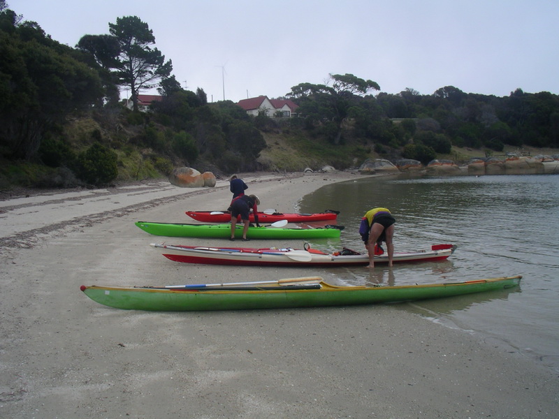
DAY 10: Preservation Island to Spike Bay, Clarke Island.
Our plans of a two-day rest were dashed when a light plane landed with
some of the island ownership connections on board and news of another planeload
on its way. So we packed quickly and made a hasty exit after informing
them of the snakes encounter and the roof space rodents.
Made a dash to Spike Bay on Clarke Island and found a cosy camp site
after a couple of aborted attempts. Had tents up and billy boiling when
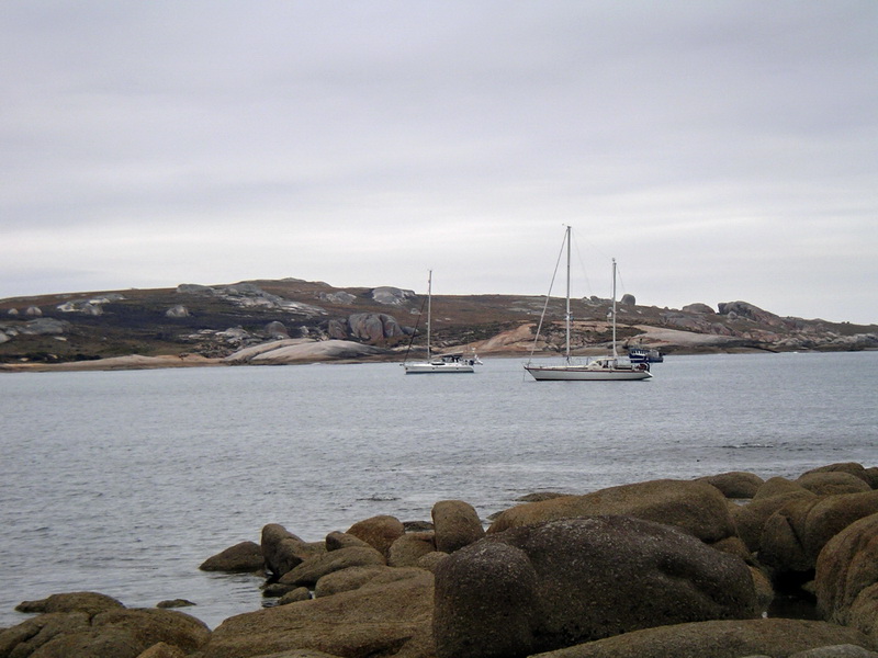
the bay started filling with yachts we suspected were in the Round Tasmania
tour, which Richard’s brother Jim was doing in his new boat Tiara.
Laurie radioed one boat and found Tiara had sailed past just five minutes
earlier. He then contacted them in the next bay preparing to anchor, so
they turned back to join us – what a stroke of luck.
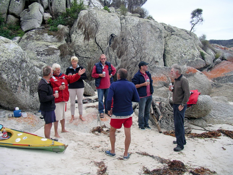
The Tiara landing party – Jim and brother Bill Hawson and Marg and Ian
McCormack – came ashore bearing gifts of cold beer and cheese and bikkies
and joined our campfire camaraderie, making it a memorable and most enjoyable
evening on an arduous adventure. And the beer and bikkies went down well
with the rice and tuna entrée and spaghetti main course Richard
and I had on the go.
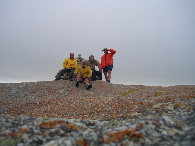
Then it was photographs all round, which went viral when Toby uploaded
one of the group of us from his phone. It was such a lucky encounter and
so good to meet up with friends from home in such a remote location when
we were supposed to be on such different courses. By rights our paddling
party should have been cruising around Flinders Island still.
DAY 11: Spike Bay to Rebecca Bay, Clarke Island.
Just a short hop, three quarters of an hour’s paddle, to Rebecca Bay
in a light southerly. The idea was to camp there and get set for the big
Banks Strait crossing to Little Musselroe Bay, and hopefully in kinder
conditions than our first encounter – fingers crossed.
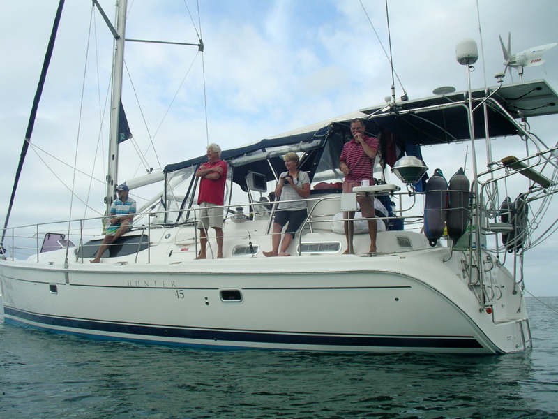
As we left we rafted up alongside Tiara and posed for pics, a few quips
and exchanged good wishes for our separate journeys.
At Rebecca Bay we pitched tents a short walk from the beach in a burnt-out camp site as light rain began and southerly winds strengthened, not good omens. But gathered under Laurie’s fly and beside the campfire we still had some luxuries to savour thanks to Tiara generosity. The fresh meat-filled rolls they had given us as we left Spike Bay went down a treat for lunch. A coldie would have been heaven.
DAY 12: Rebecca Bay, Clarke Island.
Woke at 6am to Laurie’s dulcet tones: “I wouldn't be paddling in that
today.” His reference to the stiff, persistent south easterly was good
enough for me so it was back to sleep for an extra hour or two knowing
plans for an 8am departure for Little Musselroe Bay were foiled.
Later joined Toby for a cuppa with the spiders, and then a short trek
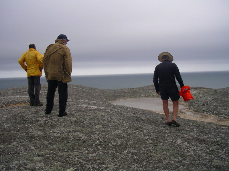
to Lookout Hill (Clarke Island’s highest point) where it was blowing a
gale. On a good day Laurie reckoned it was possible to see Swan Island,
Little Musselroe Bay and the wind turbines on the Tassie mainland. Not
today.
Toby found fresh rainwater pools in the granite rocks and returned later
to collect some in his empty water containers, and even filled my 2.5l
bottle such was his enthusiasm for the find.
Tea of pasta and baked beans, then early bed to build up strength for
the crossing challenge in the morning should a northerly of some description
arrive. Rain overnight and wind dropped out.
DAY 13: Rebecca Bay to Little Musselroe Bay.
Up at 6am, planning an 8.30am departure because the wind had dropped
and there was a forecast of slight north easterlies and, more importantly,
no strong wind warnings!! We novices liked hearing that.
Off into the overcast and misty conditions with very little wind. Actually
got going at 8am, earlier than planned, as all were keen to leave the fire-blackened
camp site after two days of waiting our chance to tackle the strait and
get home.
Laurie pushed us off into a small surf, then it was sails up and scrambling through a choppy tidal race off the point before heading magnetic south and aiming for Cape Portland on the north-east Tassie shoreline. It was somewhere out there in the heavy mist and gloom …. in Laurie we trusted, kept paddling and headed south.
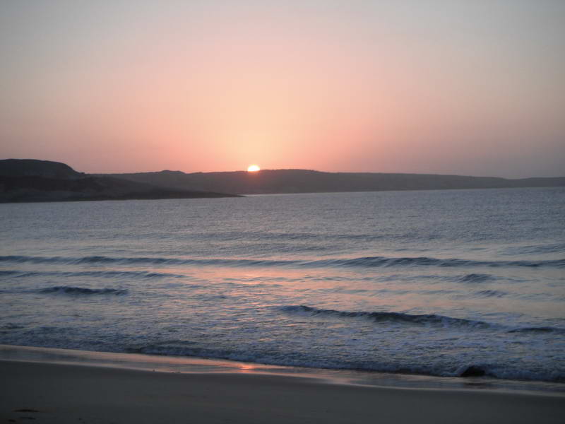 Sunrise
the last day (Richard's photo)
Sunrise
the last day (Richard's photo)
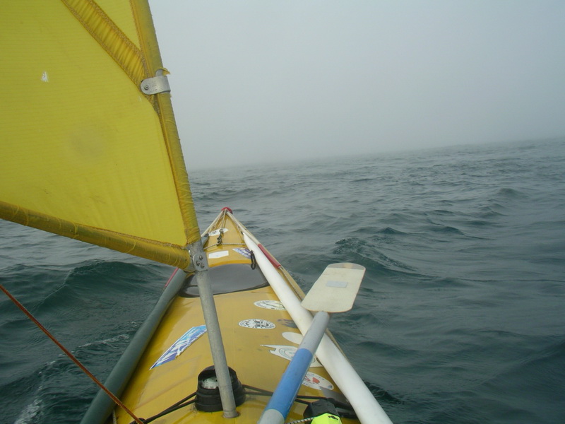
 Rafted up for refreshments (Toby's photo)
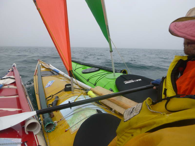
After paddling into the unknown for a couple of hours in fairly calm conditions we rafted up to have a drink and a hit of jelly beans. Toby gave me a small Coke, which was much appreciated, but I was thankful I’d had a couple of neurofen before setting out to keep any headaches at bay – the symptom that had hit me on dehydration day.
Kept paddling among the muttonbirds (envious of their seafaring abilities)
for another two hours, straining the eyes to glimpse that sight of land.
Then it was spontaneous cheers all round – out of the gloom we welcomed
the sight of north east Tasmania. The current had guided us to somewhere
north of Ringarooma Bay was the best guess from looking at the shore and
comparing it to the maps.
“If they’re not doing a haka it’s a good sign,” was Toby’s dry quip.
Then closer, and the imposing and welcome sight of mighty wind turbines came into clearer view and we knew we had made it, no fear of a Kiwi welcoming party and a human hangi. The current continued to provide assistance for a gentle sail down the coastline, ruffled only by a couple of tricky patches off points.
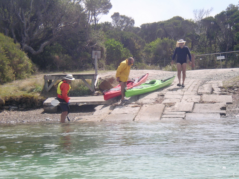
Reached the entrance to Little Musselroe Bay lagoon and the trip threw up another adversary – a final twist to the tale. A tidal race was surging out, making it impossible for Richard and me to paddle through it and into the quieter lagoon waters and our landing spot.
No doubt realising our predicament, Laurie had landed on the beach beside the lagoon outlet and guided us into the same landing through the small surf – video camera in hand, no doubt entertaining a final capsize. We both made it to shore intact and walked our boats around the beach edge into the lagoon while watching Toby, the experienced river paddler, back up and successfully tackle the rapid-like lagoon entrance – making it look easy.
Crossed the calmer inner lagoon to the boat ramp and we were there, back to where it all began, five hours paddle from Rebecca Bay and a drama-free crossing of Banks Strait – TCFT!
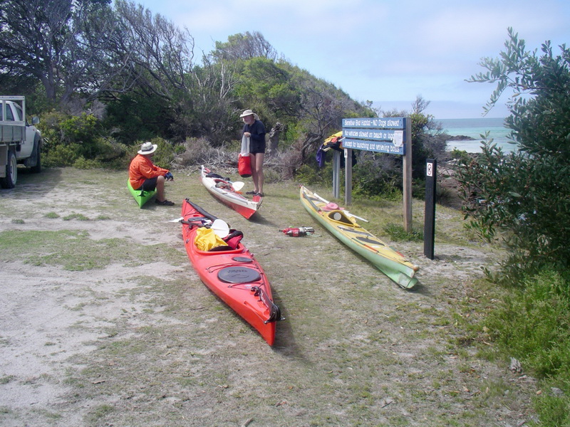
Retrieved vehicles from Liz Ponting’s generous care, unpacked boats,
had a dip, changed into clean dry clothes and had a celebratory Coopers,
which had remained relatively cool in Richard’s ute. Stress over, bum cheeks
relaxed.
Congratulations all round and sincere thanks to our Capt Grumpy for
a tough but successful trip, his pre-trip organisation and training and
his huge experience in correctly reading the tides and winds that were
vital in bringing us home safely.
John Lawler,
Official scribe.
NB: This is the one official and factual account of our trip, despite
what other versions may allege. All print rights and reproductions fully
protected.
 back
to top
back
to top