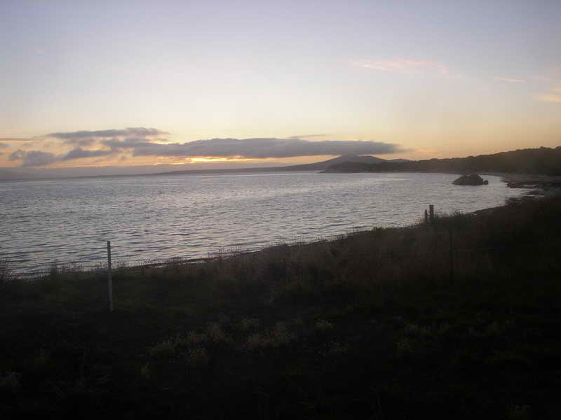
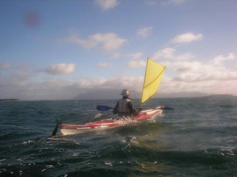
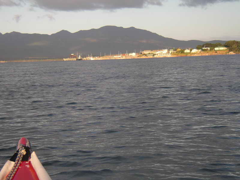
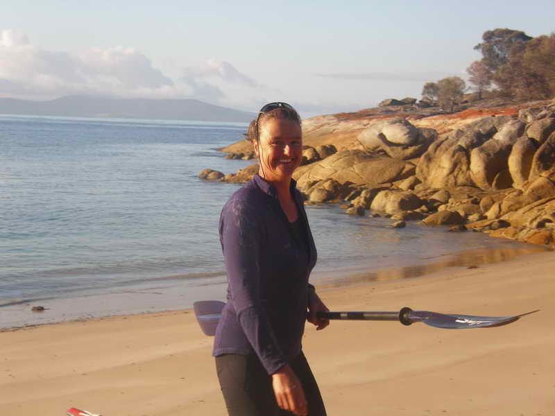
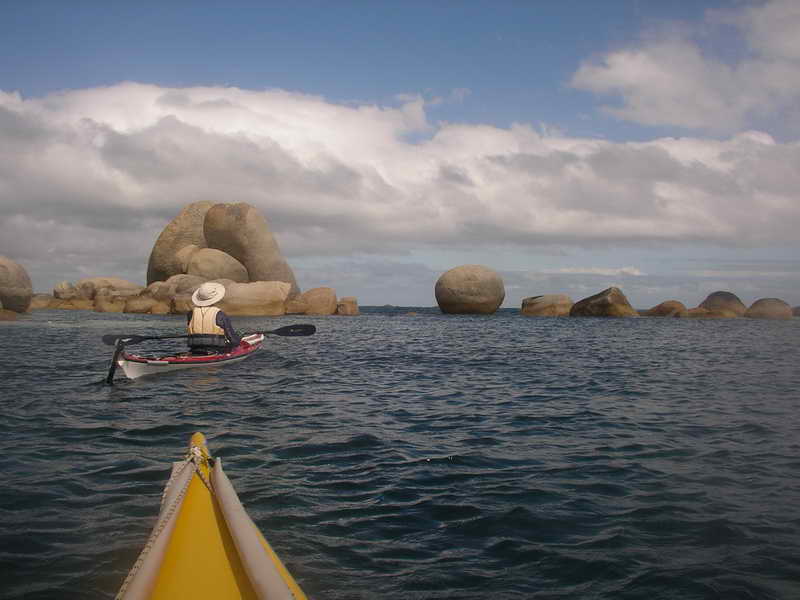
 The
start at Little Musselroe Bay.
The
start at Little Musselroe Bay.
Sue Shearman (The Girl), Laurie Ford (OM – old man)
(A mixture of photos from both of us)
Sunday 23rd February.
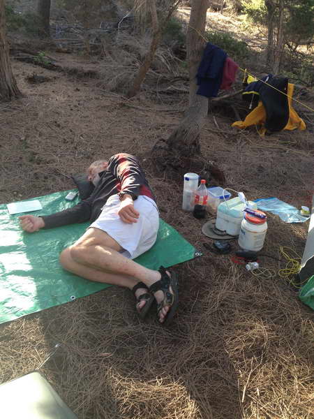
What on earth were we thinking of? Here we were in the middle of the day driving north heading for Little Musselroe Bay with kayaks and gear for a 10 day paddle out to Flinders Island. The Girl hadn't done any paddling for about 7 years, and my age of 74 is not the ideal time of life to do this again. Both of us had been out to Flinders Island many times in the past and know that it is one of the lovely places for real sea kayakers to go to. It is almost exactly 16 years since we did our first trip together out to Albatross Island.
Of course having a doctor along with me made me feel safer, and I hope she was only joking when she said not to expect the “kiss of life” if I had a heart attack!
About 12 months ago two friends of mine had bought plastic sea kayaks at the end of summer sale and I had gone out with them a couple of times to teach them the basics of paddling. I'd suggested then that they could easily do a trip to Flinders Island next summer (this one), and one of the practice paddles then had been with Sue when we started from her place to paddle down the channel. Her kayak was a bit of a mess and hadn't been used for 6 years – not surprising she hadn't been paddling. I put in a lot of work rebuilding the footrest and freeing up the rudder. I totally remodelled the fibreglass seat and thigh braces, and various other small jobs. We were still adjusting the back strap and the length of the foot pedals during this trip and finally got them right the second last day.
My friends decided not to train for this trip so it was just the Girl and I going out for 2 hours every week or so, till we decided we could probably paddle for 4 hours OK without too much trouble. This is about the time for the longest open crossing across to Clarke Island from Little Musselroe Bay where we always start from.
I'd lent Sue my small Microlight tent to save her taking her 3 man tent. I lent her one of my waterproof cameras, and I was carrying my Coleman pressure stove to save her taking her larger Trangia. I'd borrowed a down sleeping bag from her which was smaller than my polyfill one. I'd cooked us each a large container of cheese biscuits.
Well before the trip I'd posted out a proposed plan of where we'd go given reasonable weather. I always do this for trips. I have seen and heard of so many trips where the group gets away and then people start saying “But I thought we were going to go there, or to this island, or whatever.”
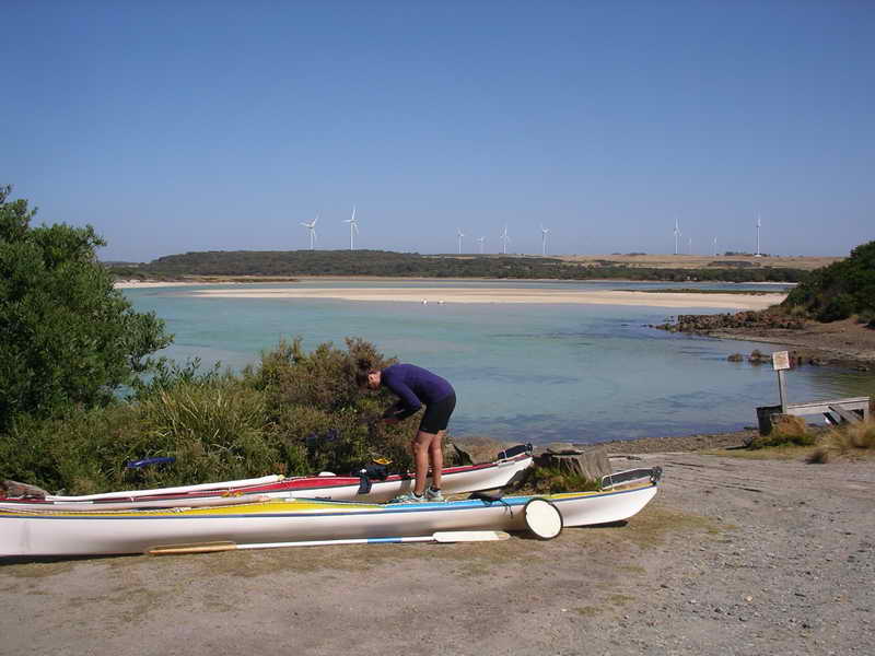
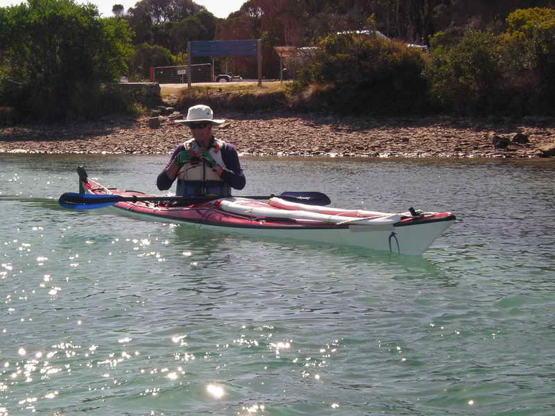
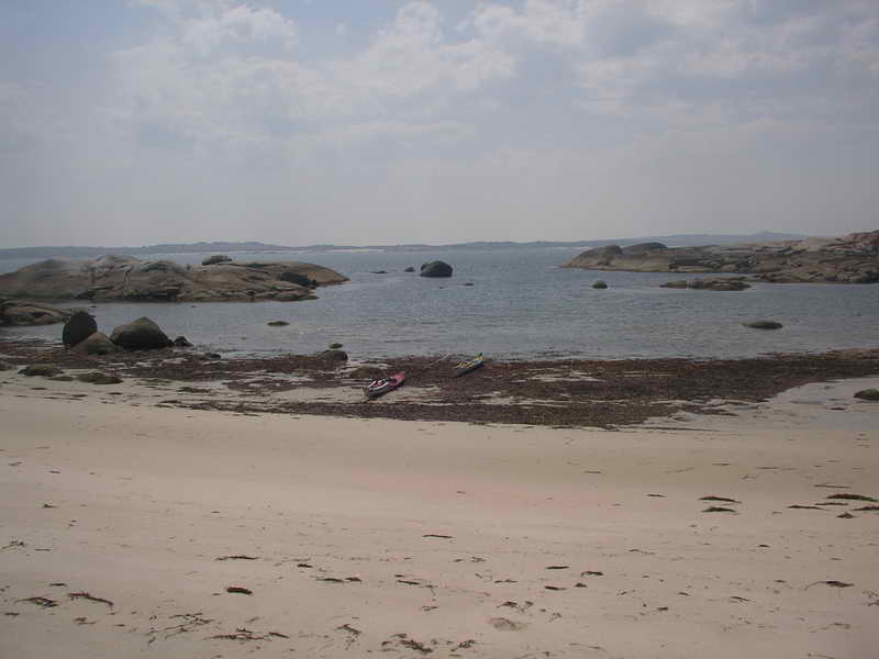
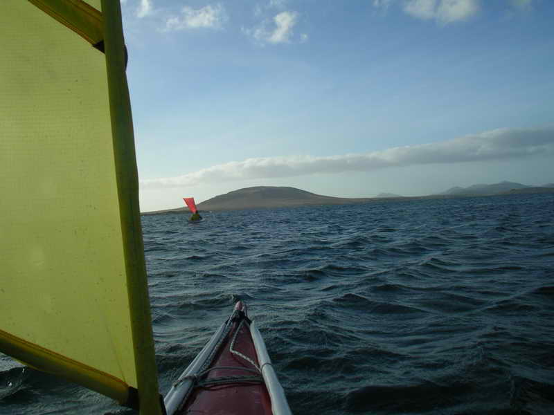
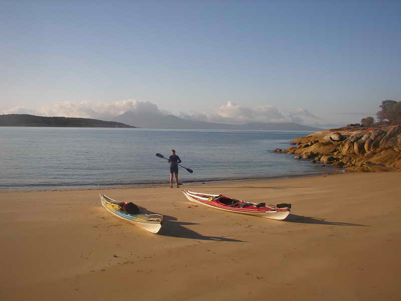
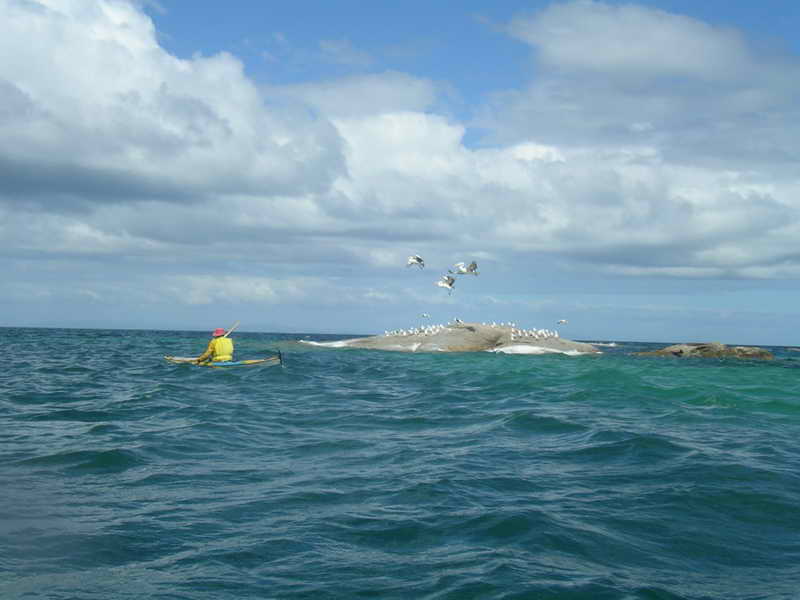
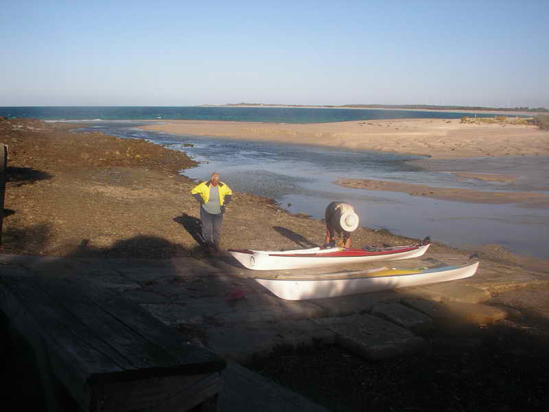
The plan for today was to camp at Little Musselroe and paddle across to Swan Island early in the morning. But we arrived at Little Musselroe Bay in plenty of time to pack the kayaks and take advantage of the good conditions and following wind to go across to Swan Island. We talked to Liz and Adrian Ponting at Little Musselroe Bay – the permanent residents – and they let us leave my Hilux inside their property before setting off.
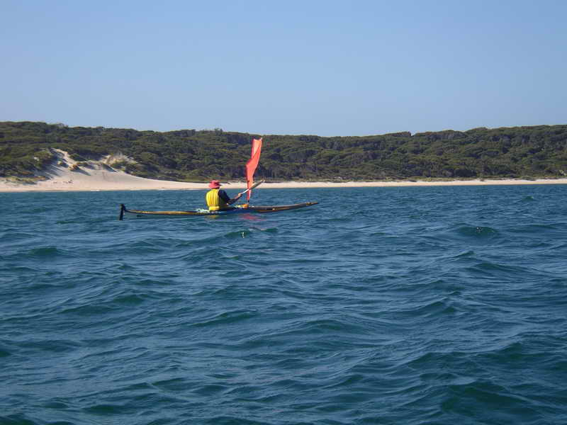
The
start at Little Musselroe Bay.
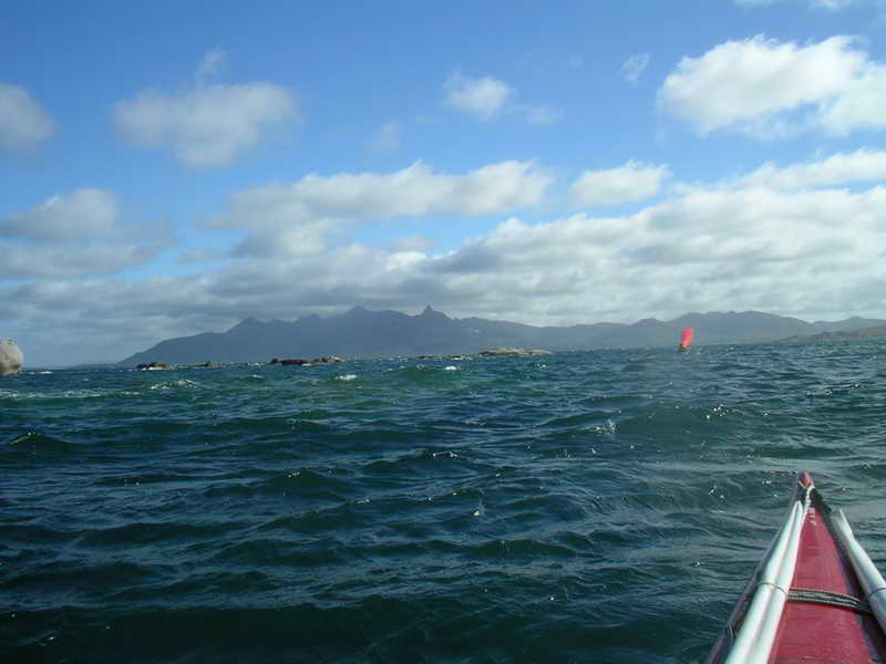
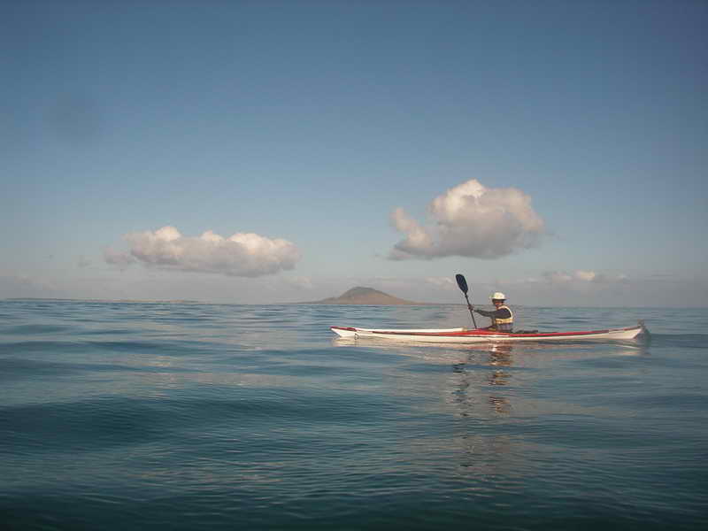
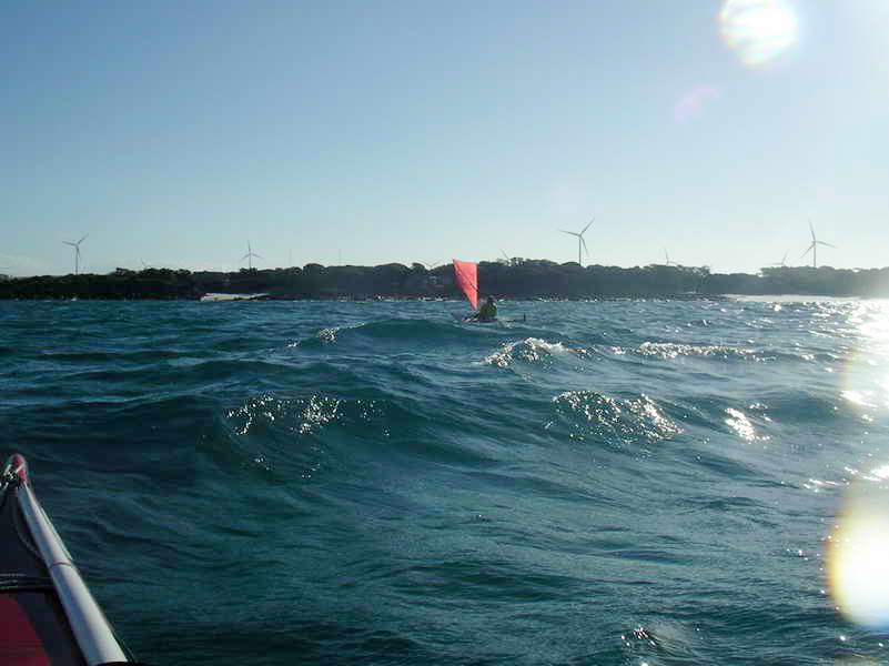
 Crossing
to Swan Island.
Crossing
to Swan Island.

 The
Swan Island Lighthouse.
The
Swan Island Lighthouse.
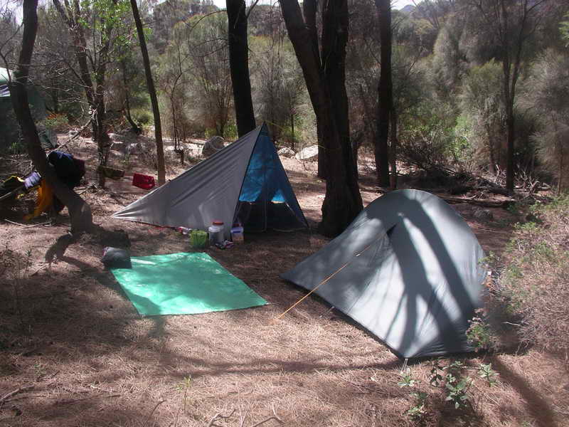
It was an easy paddle/sail across to Swan and we landed on the last big beach on the SE corner – a short walk from the lighthouse. There was no one on the island – we walked to the houses, and then over to the air strip. My first ever trip to Swan Island was in 1984 – exactly 30 years ago. Then we set up our tents on the 4WD track just behind the beach – and we camped in the same spot this time.
Monday 24th
The plan had been to paddle to here today, and then leave again at noon (which was dead low water) and head for Preservation Island. (See the end of this report for my discourse on tides in Banks Strait).
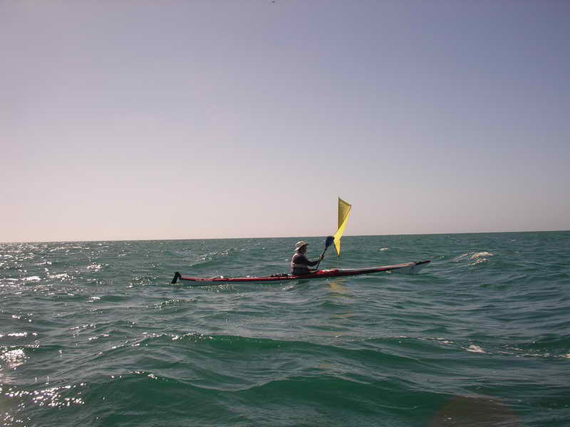
By noon a nice little SE breeze had sprung up causing some lumpy conditions round the end of Swan Island and Sue was a bit unsure about this. All our training paddles had been in pretty flat conditions. However once round the end of the island and past the shallow water off the NE corner the seas were quieter and we raised sails and used them all the way to Preservation Island. There were moments of breaking waves when we had to brace into a larger one but they were the exception and not the rule. The Girl gradually got used to bracing again, and her shoulder seemed to be taking it OK. (The whole trip had been in doubt because of one of her shoulders being quite painful for a while).
 Crossing
Banks Strait.
Crossing
Banks Strait.
As we approached Rebecca Bay and Lookout Head on Clarke Island we could see we were being swept sideways at a terrific rate by the strong current, and we couldn't have got into Rebecca Bay if we'd wanted to. Round the point we were being swept across Spike Bay and could have got in there with a little bit of hard paddling, but kept heading up along the coastline.
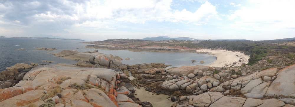
Preservation Island had a one room shack on it when I first visited it in 1982, and the owner left a big Visitors Book inside – knowing that many people used it. Fishermen anchored in the bay to wait out days of storms, yachts anchored there for some days during pleasure cruises. Groups of divers stayed there when diving on the wreck of the Sydney Cove which foundered near there in 1797. Since 1982 the ownership of the island has changed hands a couple of times and the newer owners have made substantial improvements and the one room is now a 4 bedroom establishment, with a good kitchen, bathroom, and toilet. Over the years kayak paddlers have continued to keep using it as it is never locked – and I know the owners would have trouble knowing we'd ever been in it for a brief overnight stay as we were always careful not to use any of the items in there, and swept it out before leaving. It is a very pleasant spot for an overnight stop going to or coming back from Flinders Island.
This time there had been many more improvements made, and now there were “Keep out, Private” signs on it – but it was still unlocked. We did use it this time, but I would have to say that if I ever do another trip out here to Flinders Island I think I would start not to count on using it again – pity.
As we came round the corner of Preservation Island we could see the beach in front of the shack and Sue said “Oh no, there are people there.” As we got a bit closer I called back and said “They're not people, they're kayakers.” A group of 5 with 2 doubles and a single sea kayak were just about to leave and look for a campsite round the eastern end of the island.
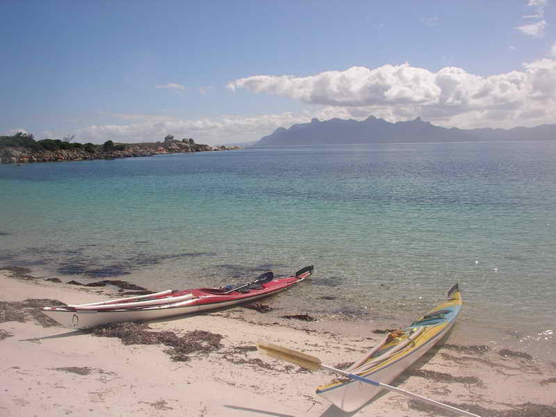
 Approaching
the beach on Preservation Island.
Approaching
the beach on Preservation Island.
After a brief chat they left and we unpacked our gear – very pleased with the 3 ½ hours it had taken us from Swan Island. A great effort by an old man and a young girl. I hadn't been sure how easy or hard this crossing of Banks Strait was going to be and had a tentative plan for a rest day here if it had been hard, but it had never been easier.
Tuesday 25th
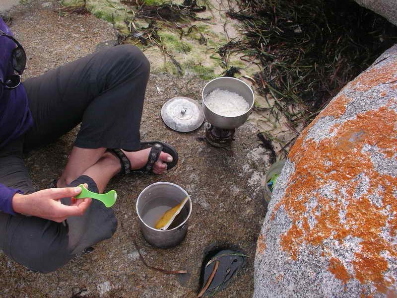
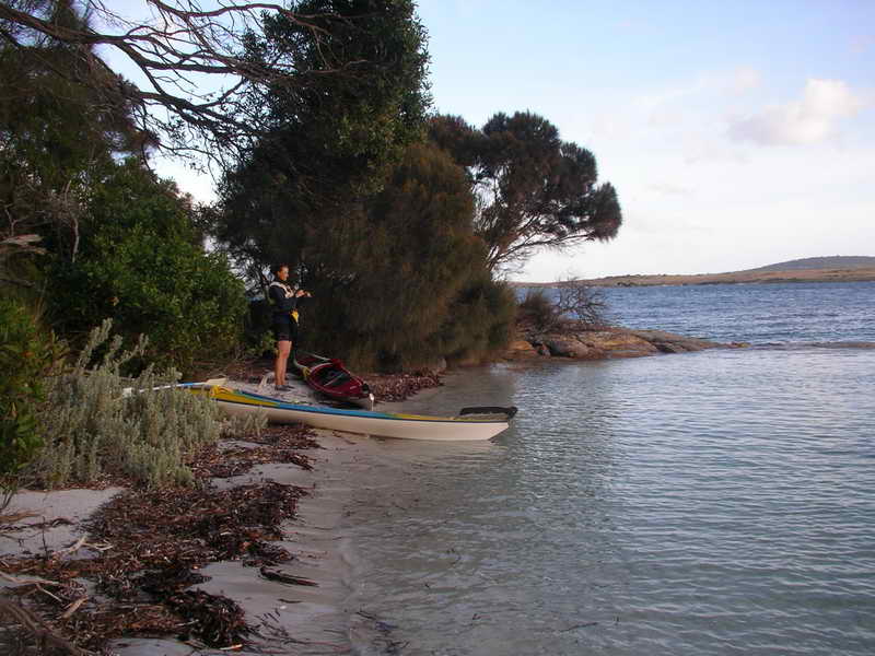
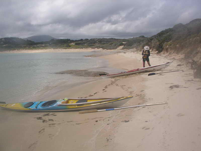
The tides were all wrong till after lunch and I had thought of only going to Thunder & Lightning Bay to camp tonight but when I looked out early in the morning there was a nice easterly breeze which would help a lot in overcoming the contrary current so I roused the Girl out and we got under way by 7.15am. We crossed over to the shoreline of Cape Barren Island and followed it along in and out of the boulders till we landed in Thunder & Lightning Bay 2 hours later – a leisurely paddle as I now intended to wait for low water before continuing on. The March Flies were pretty bad on all the sea grass that was washed up on the beach, but not quite as bad once away from the sea grass. We spent some time in locating the very excellent camp site there, as it had become a bit overgrown since I was last here back about 2005. This beach is where fresh water bubbles up out of the beach, and Sue filled one of her containers from it. It is excellent water.
 Early
morning.
Early
morning.
 The
shoreline of Cape Barren Island.
The
shoreline of Cape Barren Island.
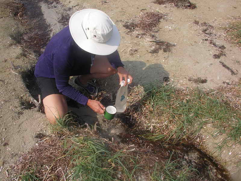 Good
fresh water.
Good
fresh water.
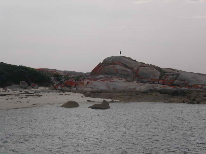
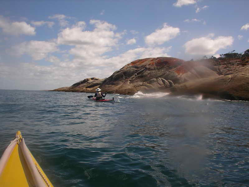
We set off again at low water, not quite sure where we would camp tonight. In one of the bays a flock of seagulls were feeding upon a school of fish which were frothing up the surface of the water. The current would not be against us going up the side of Cape Barren Island but would be once we turned the corner and headed east along Franklin Sound between Cape Barren Island and Flinders Island. I was looking for a small cove just before we got to the settlement on Cape Barren Island, a lovely small beach where Elli and I had stopped for a break many years ago – Old Township Cove. We almost went past the narrow entrance with a rock in the middle. I'd never camped in here before but after a look around we decided it would be OK – rather than fight the current along to Ned's Point which was the next possibility. That is another excellent place to camp.
Old Township Cove, Cape Barren Island.
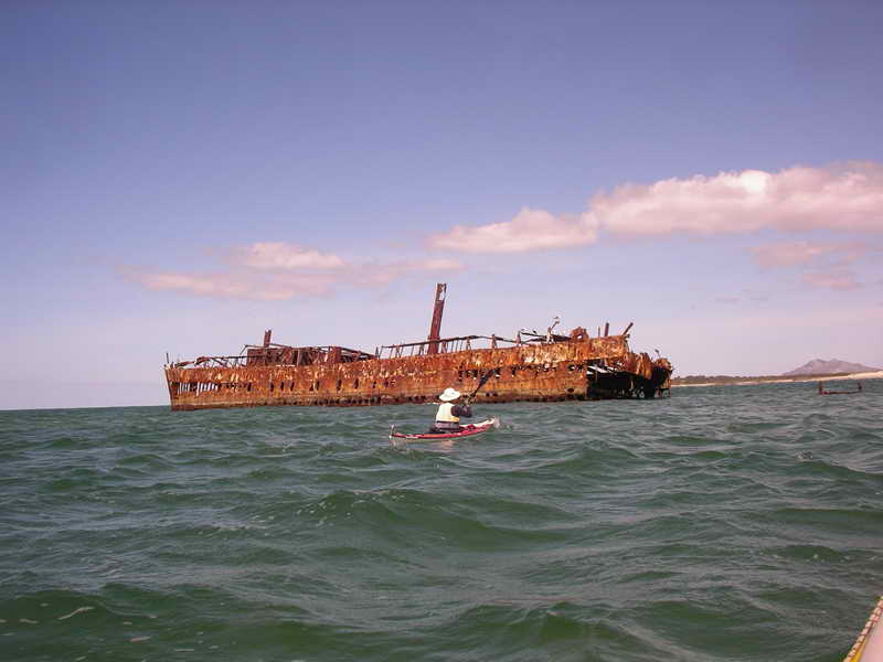
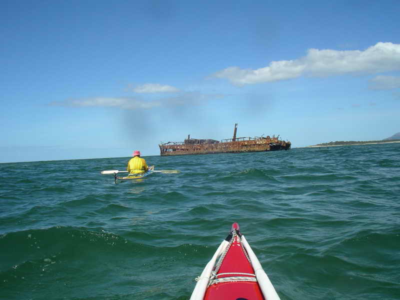
Things were looking pretty good by now. Sue's shoulder was good and I wasn't feeling too bad. We were now in sight of Trousers Point on Flinders Island which was one of the two main objectives of this trip. The other one was to visit the wreck of the Farsund.
A couple of happy paddlers.
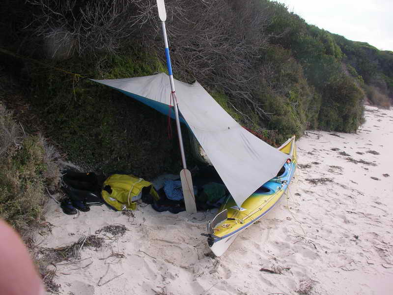
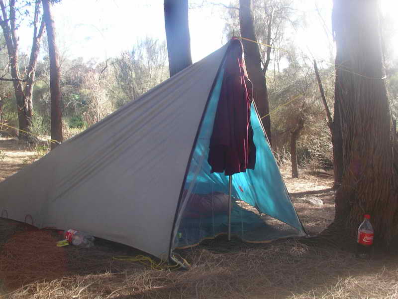
I strung my tent fly up between the kayak and some trees on the edge of the beach – a lean-to. Some time in the middle of the night it thundered and rained and the sky was constantly lit with lightning – but briefly.
Wednesday 26th
Well!!!! One not so happy paddler this morning. A good westerly wind had sprung up overnight, and there was actually a “strong wind warning” for Franklin Sound. Sue had camped up on top of the small cliff while I was down on the beach. She could look out over the Sound and see big breakers along the shore, and partly across the entrance to the cove.
I rarely hear a strong wind warning these days without a smile and thinking of Kamikaze. This was the nick-name of a young lady school teacher who belonged to the club some years ago. We were paddling near Schouten Island and there was a fishing boat anchored sheltering from the strong wind. Kamikaze paddled very close to the boat and a very irate skipper came out of the deckhouse and said “Don't you know there is a strong wind warning?” She looked up at him with a sweet smile and said “We laugh at strong wind warnings.” That almost became a motto of the club.
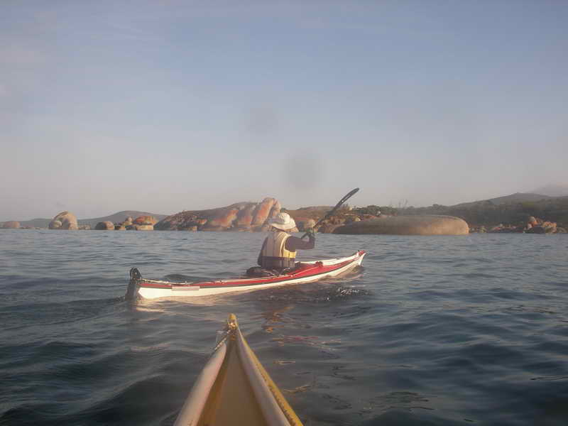
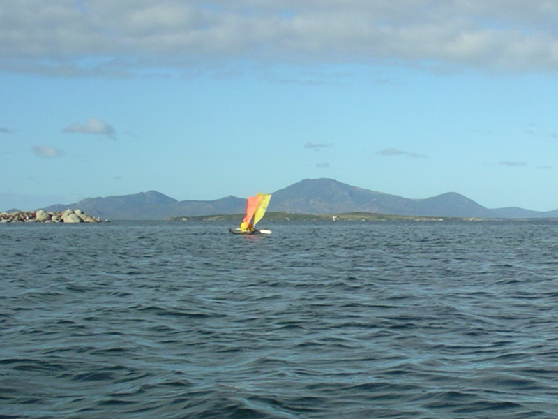
But at 8.10am Sue followed me out as we punched into a few breakers till out away from the shoreline where it was more settled – so much so that it wasn't very long before we both had sails up. Then I saw the Girl holding the paddle with one hand while she took some photographs. To do that with the sail up definitely shows a bit of confidence.
 Running
east through Franklin Sound.
Running
east through Franklin Sound.

The plan only had us going to Ned's Point today, but with this wind and the current with us we had one of the best days and went across to Anderson Island and then along the shore of Flinders Island to Dog Island and then to Great Dog Island. The wind was getting fairly strong by then and the seas quite lumpy and I thought it time to take my sail down before anything happened. The Girl had just been thinking the same thing and at that moment got a bigger gust which forced the sail cord out of the jam cleat – so we paddled along the lee side of the island to the end where we could look across to Vansittart Island. The channel was wild, and I mean wild. A sea of white caps and the tide would be running through at its maximum speed – New Zealand next stop if we tried to cross it. After a look ashore at the very decrepit buildings there for the mutton birders we back tracked along the shore till we found a very nice place to camp out of the wind. A small beach where the high tide would cover all of it, but a perfect site under the She Oaks for our tents – a tent fly in my case. I've always just used a tent fly to camp under for many many years when on my own.
 Great
Dog Island.
Great
Dog Island.

 Kayaks
raised above high water.
Kayaks
raised above high water.
Later in the evening we had a small camp fire on the sand, but the rising tide flooded it before 7.30pm and washed it out to sea.


Thursday 27th
Today our proposed plan said to be at the wreck of the Farsund at low water (3.25pm) and so we did. We left Great Dog Island about high water and easily crossed over to Vansittart with very little wind and stopped along past Ross Point and looked for camp places under the She Oaks that grew right above the beaches. After scratching our legs floundering round in the scrub Sue found a good place right on the bank just above the beach and we moved our kayaks along to there to wait till mid-afternoon for the right tide. An extremely pleasant day lazing in the sun most of the time – although Sue did go off on her own and climbed to the top of the hill. When she came down again she bumped into a visitor to the island who had his all-terrain vehicle down on the beach and was fishing. Sue had a very long pleasant conversation with him about the owners use of the island and plans for it. He drove along past us later on, and then back again.
 Vansittart
Island.
Vansittart
Island.

View from the top
of the hill, looking down
on the Farsund.

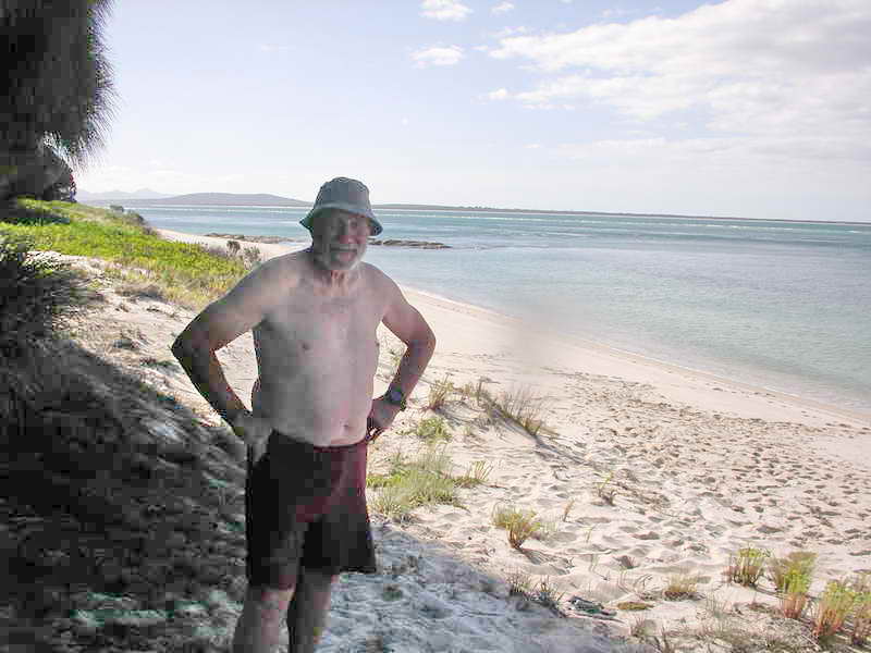
I forgot to mention that some years ago when we both paddled with a kayak club there was one young fella who EVERY TIME we landed he would IMMEDIATELY strip down to the waist so everyone could admire his body. Well he wasn't on this trip of course, so I had to be Phil on this trip and strip down to the waist when we landed.
 Phil
impersonation.
Phil
impersonation.
We duly launched our kayaks and paddled the short distance to the Farsund which is now in a very bad state compared to when we last saw it years ago. The stern has fallen off and it won't be many years before it will no longer look like a ship, but just a heap of rust. We paddled back and camped in our chosen spot, not having put the tents up before on the thousand and one chance that something may have stopped us getting back there.
The last couple of days we had seen lots of Mutton Birds in flocks as they wheeled and dived in an endless pretty flowing pattern. This afternoon three or four Dolphins swam past just a few metres off where we were lazing on the beach – but they were gone in a few minutes.
Sue put her tent up but I decided to try just sleeping under the She Oaks without the tent fly. This was great till about midnight when a fresh easterly wind sprang up and I noticed a few clouds out on the horizon. This might have meant rain so seeing I was awake I went in behind the She Oaks to a more sheltered spot which we had checked out and quickly strung the tent fly up between the trees and carried the ground sheet and sleeping bag up in one bundle. It only took a few minutes and I was back in bed again.
Friday 28th
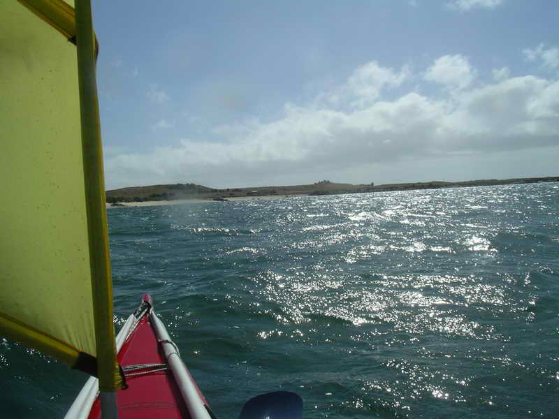
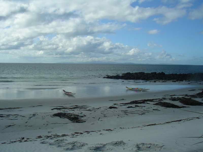
Our proposed plan said to leave at 8.30am for the township of Lady Barron, and then camp nearby at Badger Corner. That was because the tide would have been against us all the way round to Trousers Point if we kept going.
BUT, all that changed with this easterly wind. It was easily strong enough to help against the current and we got away at 6.30am. When we arrived at the harbour of Lady Barron we now found it totally surrounded by a security fence and the boat ramp we normally land on was no longer available. The man on duty there said there was a small beach around the corner, and when asked said we could go back to him and get some water. We landed on a very small beach just round the corner past the wharf area and walked back and the man opened the big sliding gates and showed us a tap for Sue to fill several water bottle. He said the fence had only been up for 3 months. Then while I adjusted her footrest again Sue walked up to the store for 2 bottles of Coke.
 Approaching
Lady Barron.
Approaching
Lady Barron.
This is something she never normally drinks, but does carry it in the cockpit for long crossings – as do many other sea kayakers. Back in 1999 we had an old man on his first ever big sea kayak trip (to Flinders Island) and he had bought some sports drink thinking it would help on the Banks Strait crossing. When he tried it it nearly made him sick and he was desperate for a drink so I gave him some of my Coke – he hadn't drunk that in 40 years. He said it saved his life and a couple of days later when we got to the township of Whitemark he was seen with 2 shopping bags with Coke. A lot of sea kayakers do drink Coke on trips, but never ever have it in their houses, and don't drink it between kayak trips.
So after this re-supply we headed for Trousers Point and sailed all the way. Rounding the points on the way we could see the current flowing in the opposite direction like a river just off shore. We were both a bit tired when we got ashore at Trousers Point, but exhilarated on getting there.
 Heading
for Trousers Point.
Heading
for Trousers Point.
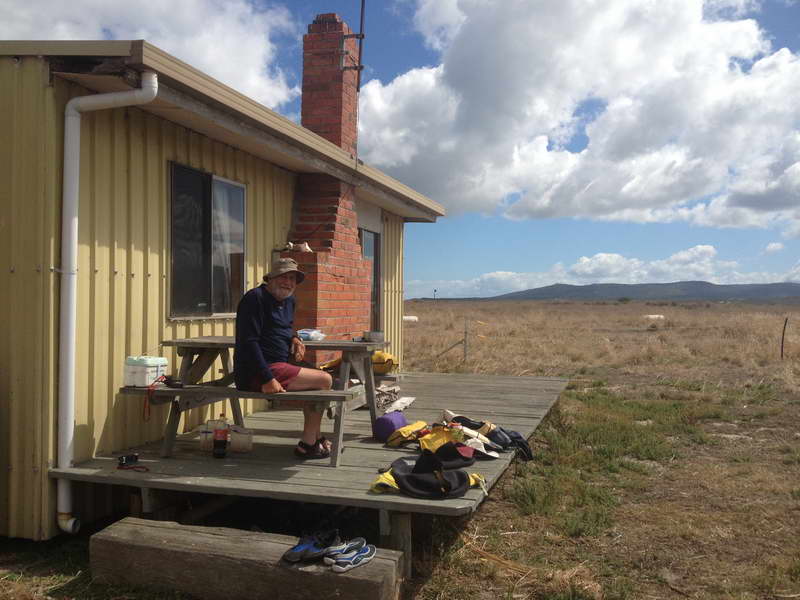
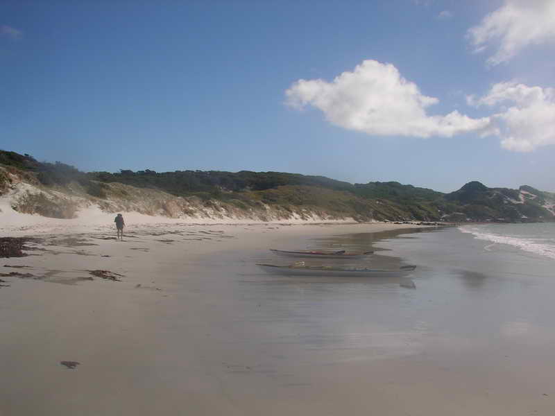
Actually that is a bit of an understatement – I was VERY tired. I found it a struggle to make the few trips to carry my gear up to the spot where we decided to camp. There are some quite steep steps up from the beach to the good council camp ground and the two days we were here they didn't get any easier for me.
The camp ground was fairly occupied by a tour group from Australian Wilderness Adventures with numerous small tents everywhere. A good friendly group and a well-run tour by the look of it. Sue chatted to them but I had to get off my feet. Not sure why it was my legs and feet that felt so weak, but my arms and shoulders seemed fine for paddling still.
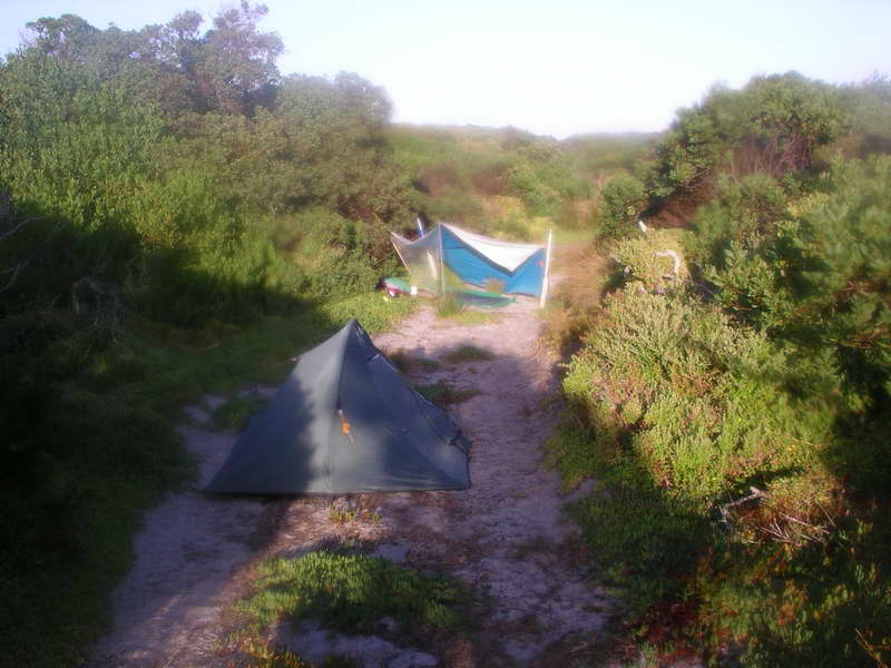
 Minor
sewing repairs at Trousers Point.
Minor
sewing repairs at Trousers Point.

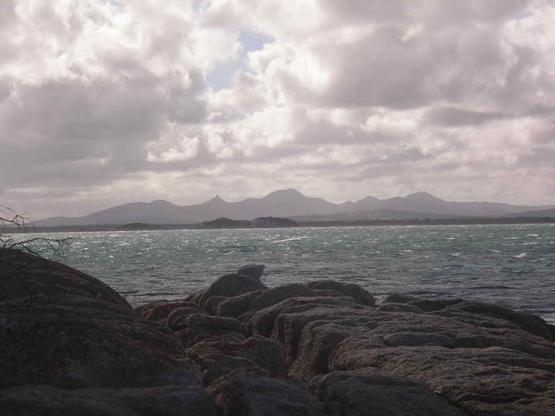
Strzelecki Peaks.
 The
cove with the steps where we always land.
The
cove with the steps where we always land.
But one person (not from the tour) did chat to me briefly and said her partner Bruce used to do a lot of kayaking. Bruce who? Bruce Davies. He is one of the people that actually got me into kayaking back in the 70's, and we had done quite a few trips together since then. Small world because I hadn't seen him since the late 80's. He and Colleen were in the big tent right next to where Sue and I had camped. They had brought their 4WD over on the ferry for a couple of weeks sightseeing.
Saturday 1st March
Bruce came over for a chat first thing.
Sue planned to climb Mt Strzelecki today, and so were the tour group so she got a lift with them to the start of the track – but then went at her own (fast) pace. Hour and a quarter to the top she said. She walked back to the camp ground. I spent the whole day either sitting or lying down, and had a 2 hour sleep in the middle of the day – saving myself for the return paddle to Little Musselroe Bay.
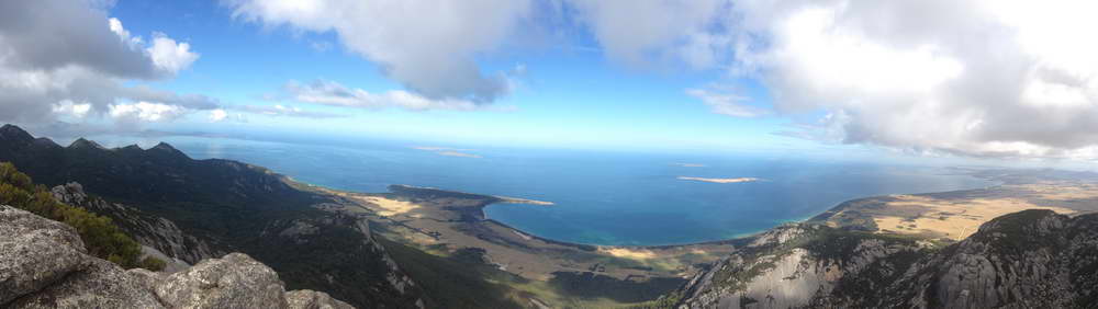
View from the top of Strzelecki.
 A
tired OM.
A
tired OM.
I did move Sue's footrest forward another notch, and I put my small solar panel in the sun with the battery out of the kayak and charged the VHF radio and Sue's spare battery for her IPhone, and a few other batteries for cameras and radio. Good sunny day. It was about here that we noticed Sue's rudder was very loose and wobbly and looked as though it was about to fall off – which reminded us of a trip on Macquarie Harbour in 1998 when it did actually fall off. I took it apart and had a good look at it and decided it wasn't going to fall off on this trip so put it back together. (I made a decent repair of it when we got back home).
 Charging
the batteries.
Charging
the batteries.
I've had the waterproof VHF radio way back from the days when I used to work for Coast Radio Hobart, and had brought it along just to get the forecasts each day. Reception from Coast Radio Hobart was very sketchy in places – Preservation Island you only had to move a metre and you would lose them. Same on Great Dog Island. I only turned it on at their sked times, but next time I think I'd have to look up Tamar Sea Rescue sked times and try them. The Girl had also bought herself a “Spot Tracker” before the trip. Her cousin uses one paddling and bushwalking and recommended it to her – a great way for her family and friends to be able to see where she was every day. It updates a webpage every half an hour, and can also send pre-recorded messages, or send a “Mayday”. We had used it on one of our training paddles and it was fun to get home and immediately look online and see where we'd been.
 Mt
Chappell Island.
Mt
Chappell Island.
Sunday 2nd
We left Trousers Point about 9am and had a 2 hour paddle across to Long Island in very flat sunny windless conditions. Had a 20 minute break on the beach here and then just as we left an Easterly breeze started up.
 About
to leave Trousers Point.
About
to leave Trousers Point.
 20
minute rest on Long Island.
20
minute rest on Long Island.
Down the side of Cape Barren Island we went in close to the shore to keep out of this wind, but on rounding Cape Sir John were full into it with no shelter till we got across the bay to Key Island. This was a bit of a battle all the way and just past here we went ashore on a sheltered beach for an hours rest.
 1
hour rest near Key Island.
1
hour rest near Key Island.
The tide was still running flat out in the direction of Preservation Island where we were headed so there was no need to hurry. Then it was out into the wind again and paddled diagonally across the wind and current to arrive at the shack on Preservation in another hour. This was probably our hardest day so far but we both felt pretty good as we got our gear out again. Sue put her tent up out the back of the shack but just after dark I could see her light flashing on everywhere and a lot of noise and eventually I heard her come back inside to sleep, having taken the tent down and packed it away. Rats and mice were threatening to chew their way into her tent.
Monday 3rd
Waiting.
I made my first mistake with the tides today. Most kayakers going back across Banks Strait to Little Musselroe Bay leave from Clarke Island, it being the shortest distance to paddle. But I have made some quicker trips across here starting from Preservation Island and using the tides – similar to using them on our trip from Swan Island to here 9 days ago. But these were many years ago and I was a bit hazy about exactly what state of the tide we should leave. I thought it was an hour before high water at Preservation Island, and that's when we left – with a slight NE wind to help. But after an hour that dropped out and we paddled for the next hour or so – and I was starting to think this is going to be a long 4 hours, feeling a bit tired. About now Sue felt a sort of migraine starting to develop with face and head pain and took some aspirin. She did not feel great for some time after this.
 Leaving
Preservation Island.
Leaving
Preservation Island.
Then the wind came in again quite strongly again and on we sailed again – still heading magnetic S and watching the land ahead of us. By now Swan Island was way across to our left and I told Sue that at least we were now safe as we could always run down towards it. But we headed in for Little Musselroe Bay, surging down the waves with the wind behind us. After half an hour or so I realised we weren't getting any closer to the shore we were pointing at, and when I looked over my shoulder I could see that the lighthouse on Swan Island was much closer. We were going backwards with the extremely strong tide running from west to east – despite the following seas and wind.
I gave up and changed direction 90 degrees and had an easy paddle to the second beach near the lighthouse and we went ashore for an hour or so to give the tide a chance to die out a bit. 3 3/4 hours from Preservation to Swan Island.
 Ashore
on Swan Island.
Ashore
on Swan Island.
The tide coming round Cape Portland splits with the main current going out round the north end of Swan Island, and a smaller flow down the coast between Swan Island and Tasmania. We hadn't quite got into this part of the current. If we'd left Preservation Island half an hour earlier we probably would have made it OK.
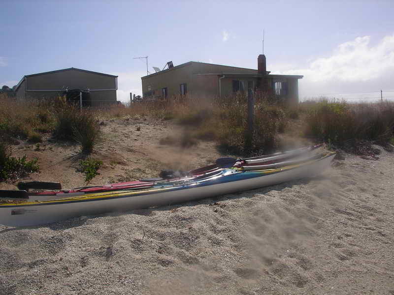
We walked along both the beaches here while waiting and found some very fresh footprints that indicated 2 people had been on the beach earlier today – one with small feet and one person with huge feet. Then it was an easy paddle straight inshore to Little Musselroe Bay where Liz Ponting had just got home from work and saw us coming and met us at the boat ramp. We had to drag our kayaks into the bay and Liz said she had never seen the tide so low.
 The
last leg.
The
last leg.
 Little
Musselroe Bay.
Little
Musselroe Bay.
And so ended another great trip with The Girl, neither of us thought we'd ever paddle out to Flinders Island again. We did about 205km all up (127 miles, or 110 nautical miles).
We drove home via Bridport and Launceston, sampling meat pies at Launceston before arriving back at my place at Dodges Ferry at midnight. Sue then had another hours drive to her place.
My old website used to suggest
that people start paddling
across Banks
Strait either 2 hours before High Water, or 2 hours before Low Water
–
depending on which side of Cape Barren Island they wanted to go up. Use
the tide tables for Swan Island.
If heading for Preservation and then Cape Sir John then you would leave
2 hours before Low Water and head magnetic N. You would be taken east
for
2 hours, then west for 2 hours just as you approach Clarke Island and
the
tide would then take you up along the side of Clarke Island towards
Preservation
Island.
If you wanted to go through Sea Lion Narrows and up the eastern side
of Cape Barren Island then you would leave 2 hours before High Water,
again
heading magnetic N.
 Laurie Ford.