The channel just after the launch site.
Back in November 2004 I got an email from a paddler in Baltimore, asking for info about paddling in Tasmania as he would be out in Australia in February 2005. I was in the USA at the time, but we (Elli and I) said we would organise a trip to Maria Island for him and his mate - and provide the sea kayaks. We would be back in Tasmania by then, continuing with our house building. To protect the innocent I'm going to call this guy 'Peter Pan'.
This was part of his reply:
"The trip you suggest sounds great, and it would be
wonderful
to do it with you guys. How much lead time would you need
before
nailing it down? I am dealing with the Qld government and they have
been
unreliable in the past (saying "yes its a go" and then when I have my
plane
tickets firmly in hand, saying "um, wait a minute, there's a new
minister
and he doesn't really understand, so can you you wait and come back
next
year?"), so I'm not 100% sure that this thing is going to
happen.
I should know more clearly in a month or so. Is that ok?
"
When he heard we were in the USA he immediately offered this:
"Hi. Here's an idea. Since you are going to be around
until after
Christmas, would you and Elli be interested in coming here some weekend
in early December and doing a couple of day trips on the
Chesapeake?
There are some really nice places to go within a 1-2 hour drive of
Baltimore
and some absolutely spectacular places within a 3 hour drive (the
barrier
islands off of the Virginia eastern shore).
I can easily arrange to borrow a couple boats and equipment. Somewhat more problematic might be getting wetsuits, but I think I could do it (water temps will be mid-50's; air temps anywhere from 30's to 50's)."
We declined this because Elli and I were in the middle of moving into a new house, and also has social engagements - it was getting close to Christmas.
But we did send him a video of sea kayaking in Tasmania - one of Jeff Jenning's videos. (Jeff has given Elli permission to copy it for family and friends).
Almost immediately, we recieved this email from Peter Pan:
"It's a good thing you and Ellie didn't try to make
it down here
to paddle. I've been given strict orders by my doctor to STOP
PADDLING.
I've got a bulging disc in my neck. I'm finishing up a week's worth of
steroids and then start physical therapy on Monday. That will
last
for three weeks, 3 times per week. Then we'll see where I am.
This business started last summer when I was doing a lot of practice rolling and sculling. I thought I just strained my arm, hitting a roll wrong. I just kept going and going , over a 5-6 week period, and putting up with the pain. When it got worse (early Oct) I started going to different doctors and finally got the right diagnosis from a doctor I trust.
This doctor knows that I have to get back to paddling, so he's focused on getting things fixed (as opposed to just "altering my lifestyle"). If the drugs and PT don't work, I'll get an operation. I've heard recovery time is pretty quick, so I'm optimistic that we'll still be able to paddle in Feb or March."
I must confess that my immediate conversation with Elli was that this guy has just seen that Tasmanians go out in 20 ft waves and 40 knot winds and put sails up, and he is coming up with an excuse in case the weather is not flat calm in Tasmania. After all, he had just invited us to go down there right now and paddle with him, without any mention of a crook neck.
Anyway it was left at that - he was going to come to Tasmania and do the Overland track and ring us a day or so before he wanted to paddle, and then come to Hobart and paddle with Elli and me.
Back in Tasmania we checked out all our camping gear, and made sure we had enough paddling gear for my 4 sea kayaks.
We never heard from him - he never showed up to come paddling. We assumed that he never got to Tasmania.
Then in April 2005, when Elli and I were back in the USA
again, we recieved
this from Peter Pan (a group message to 13 other people)
"Anybody interested in doing a 2-3 day trip to the
Virginia barrier
islands in July and/or August? The weekends I can do it are
July
16-17/18 and August 20-21/22. I'm open to 2 days or 3. There are some
givens:
It will be hot. It will be buggy. There will be some
significant
currents. Unless conditions are really bad, I definitely want to go on
the Ocean side for at least part of the trip."
We replied and opted for July as I would be back in Tasmania by the August date.
Many emails later we got this on 2 July, 2005. (I have changed
the names
to protect the innocent):
"FYI - this is turning into a cast of thousands. I
just found
out today that two more people were invited by some one else in the
group.
It's now up to 9 people. So, we may have to split into two groups at
night
for camping/impact purposes.
Just to give you an idea about who's who:
1. Me (Peter Pan), 58 - consulting work in
juvenile justice and
child welfare. What a great guy! 5-6 yrs paddling.
2. Wendy, 50 - nurse, also paddling 5-6 yrs and very
strong.
3. Laurel, 53 - 6th grade public school teacher -
also 5 yrs
paddling. If you let him, he'll talk way too much.
4. Hardy, 58 - ironworker, paddling about 5 yrs.
Pretty strong
paddler and very good guy. He's got the house on the VA eastern shore
that
we'll use that first night.
5. Tom, 58 - retired businessman (computers)
6. Dick, 51 - physician's ass't; kayaking instructor,
great guy
7. Harry, 48? - same computer business as Tom; also
an instructor
(he and Harry are in business together as instructors)
These last three guys are real good friends and have
been paddling
together for a long time. All are very skilled paddlers.
8,9. You and Ellie"
We also recieved a lot of detailed planning like this:
3.45 pm. Hit Ship Shoal Inlet and wait 30
mins before crossing.
(Slack Before Ebb @ 1624)
10 am. Hit and cross Sand Shoal Inlet 30 mins.
before slack
(Slack Before Flood @1025)
And an almost hourly itinerary of what time we would land on what end
of what island.
So one could be excused to think we were going south to do some serious paddling with some keen paddlers - this was a 2 day drive for Elli and me, similar to driving from Cairns to Melbourne.
Elli and I arrived in Nassawadox on the appointed Friday
evening, having
just listened to the forecast for the weekend.
The forecast for Saturday was for SW winds to 8 miles an hour, and
2 foot waves.
The forecast for Sunday was for SW winds to 8 miles an hour, and 2
foot waves.
The forecast for Monday was for SW winds to 10 miles an hour, and 2
foot waves.
And there was the possibility of afternoon thunderstorms.
Elli and I were delighted, the forecast couldn't have sounded
better.
However, we were informed almost
immediately that the
trip was off, because of the
afternoon storms. Apparently
the group had decided this. Despite America being the world's biggest
democracy,
it doesn't appear to apply to kayaking groups. We mistakenly thought we
would have been part of any group discussion - but no, this decision
was
final. The group would do day
trips. We weren't quite sure
how an afternoon storm wouldn't affect a day trip, but would affect a
camping
trip - but didn't pursue the matter. Incidentally, the group was only 4
persons - Tom Dick and Harry hadn't shown up.
Fortunately Elli and I had discussed this possibility 2 weeks before we drove down there, and in view of the non-contact in Tasmania thought it a real likelihood that the trip may be cancelled because of weather. We had decided we were going to paddle regardless (a hurricane may have changed our mind).
The Trip
So early Saturday morning we drove down to the launching spot on Cape
Charles. Hardy was up as early as we were (the rest we never saw), and
very kindly offered to drive south for 20 minutes to show us the launch
spot. It is extremely unlikely we would have found it without him.
I have included a very rough map of the area just to give you an idea of what it was like. It doesn't show half the marshy islands inside, or the shallow areas on the ocean side, and is not the map we used. We did in fact have a proper commercial waterproof chart, but if I'd been anywhere near the manufacturer would have gone and asked for my money back. The area on the ocean side of the islands was probably 20 ft deep for a long way offshore, and inside the islands was mainly mud and marshy islands - the water either only a few inches deep, or drying out altogether. Lots of marshy islands have formed that were not on the chart, and even the outside of the islands had permanent extensions that were not on the chart. There appears to be one permanent deep channel on the inside, following the mainland shoreline till it went out to sea between Wreck and Cobb Islands. By deep I mean anything from 9 feet deep to 50 feet deep. There were pleasure craft running round in some of the inside area, and we did come across channels marked with tree branches stuck in the mud along the side - so obviously some of the locals know the area pretty well.
Elli and I packed our kayaks and launched into a very small muddy channel, an hour before the programmed starting time. Already the tide was so low that the kayaks were scraping the bottom - an hour later you would have had to walk and tow them, assuming it was possible to walk in that mud.
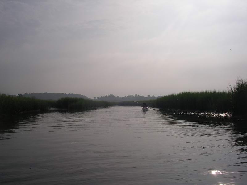
The channel just after the launch site.
Fifty metres down the narrow channel we came out into a slightly wider channel, and then shortly into a much wider channel, and followed this NE for a mile or so till we were in a large open area near Skidmore Island.

The next channel, heading NE for Skidmore
Island.
Now we could see the 180ft high Cape Charles Lighthouse across on Smith Island, and paddled straight towards it to get into the deeper channel that went past the southern end of Smith Island.
It was a hot day, somewhere around 33 degrees Centigrade at least, or over 90 degrees Fahrenheit, and very very humid.
Paddling up the outside of Smith Island was benign - smooth seas and the predicted light SW wind. There was a tiny bit of surf where slightly deeper water met the shallow bottom all along the island. These Barrier Islands are long low sandy spits, very boring to paddle along - but we had expected that.
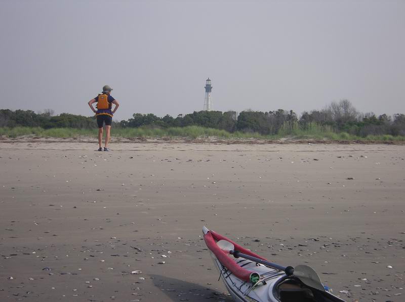
Ashore on the outside of Smith Island.
I was looking forward to seeing the 6 knot currents pouring out of the inlets, and the standing waves the group had talked about. We assumed they had paddled in this area before to be so definite about the exact times to cross the inlets.We landed on all the islands I think, just for a break in the hot weather.
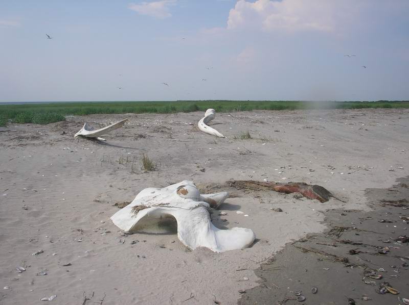
So Elli and I then went back round the inside of the island and found a dubious campsite in the long grass. Lots of birds nesting on the island, with a big tern rookery right on the southern end. We avoided this and camped where there seemed to be no nests of any sort. It was so hot we left our paddling gear on and sat in the water up to our necks for about an hour - this was delightful. Later we wandered along the beach to inspect the remains of a whale, and then came back and sat in the water again.

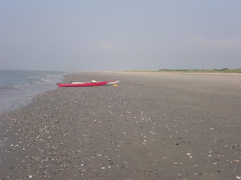
Wreck Island.
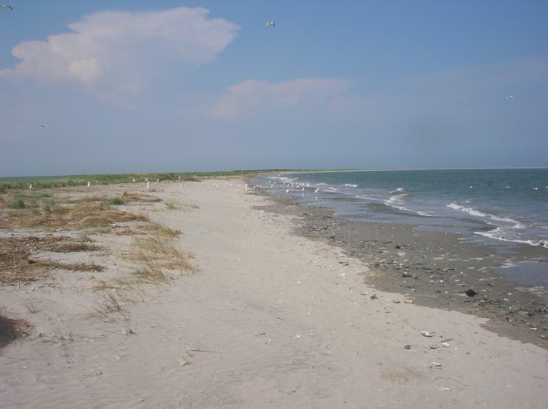
This shows the whole new area stretching way out to
the right,
where in actual fact the chart shows this stretch of beach to be dead
straight
for about 2 miles, then curve away to the left.
The inside foreshore was covered a foot deep in dead reeds from the marshes and was an excellent place to sit late in the day and watch the afternoon storms. I've always been under the impression that these summer afternoon thunder storms are mainly caused by the extremely hot air rising up from the heated land. Well we were 8 miles offshore, on a very small island covered in greenery - there was definitely no hot air rising up here, and of course no storms. But across on the mainland they were spectacular - huge bolts of lightning. We were sitting on the bed of reeds leaning against our kayaks, and every now and then as one storm petered out we would go and sit on the other side and watch a storm to the south - across the other side of Chesepeake Bay. It was a wonderful sight - made even more so by the thought that the others were probably sitting in the house right under these storms, with thunder reverberating overhead - congratulating themselves they had made the right choice. It was about now that we actually started to wonder if we were the victims of a huge practical joke. The information about crossing Ship Shoal Inlet was just pure nonsense. And in 1996 in the whole of the USA there were 93 people killed by lightning. That means that on average one person was killed every 4 days. One person was killed opening a fridge in a house, one was killed playing a computer game in a house. Work out the chances of being struck by lightning on the Barrier Islands where there isn't any super heated air to cause thunder storms in the first place. It is not even worth thinking about. And I haven't looked up the number of road deaths in the USA each year, but I wouldn't mind betting they are in the thousands - yet these same people are quite happy to drive all the way down here, but then not paddle???? Was this a practical joke. Should we call this group the Pranksters???
In the end we decided they were just totally ignorant about the whole area, and weren't happy about paddling in anything other than a dead calm sunny day.
Having said that, I can see that the next inlet between Wreck Island and Cobb Island would have fast currents flowing in and out with the change of tide. This is a deep channel. But the Ship Shoal Inlet is shallow, probably less than 10 feet - so it can't have fast currents. If it had fast currents, then they would carve a deep channel - no deep channel, no fast currents.
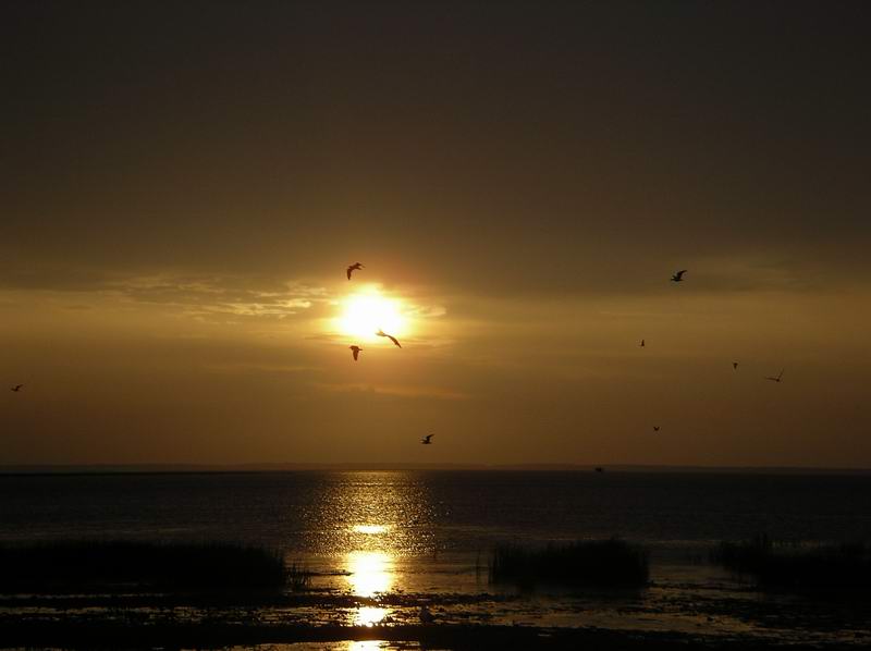
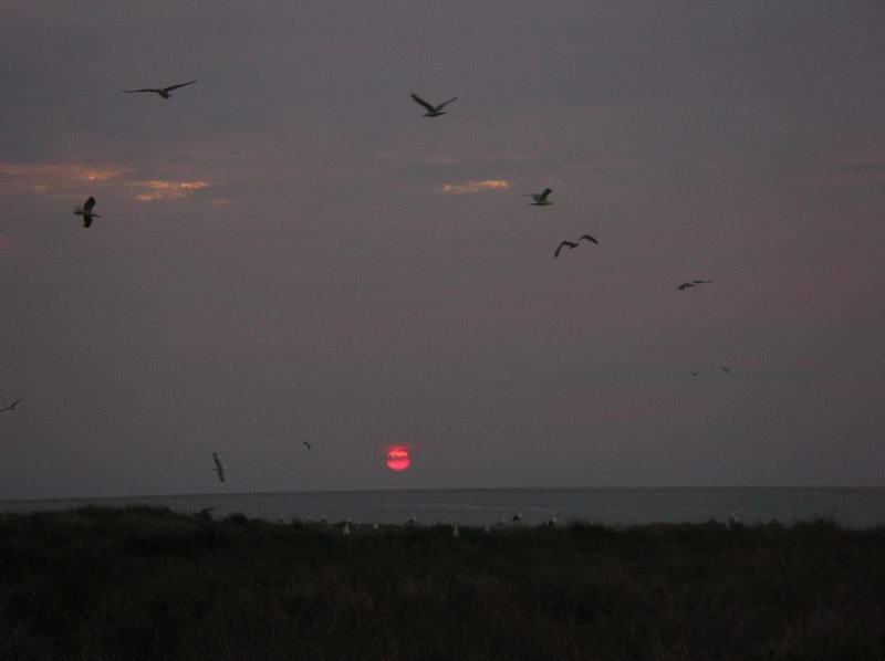
The sunset from Wreck Island, and the sunrise the
next morning.
The original trip planned had cars at each end, so we would have kept paddling north. But our car was south, so as we thought we'd had enough of a look at the area we decided we would paddle back down the inside of the islands. We were on the water at 6.30am to get the most from the high water (low water about 11am). Not being terribly keen to spend the day in 6 inches of water we figured on paddling NNW and getting into the deep channel, but some unchartered marsh islands threw our navigation off quite a bit and we ended up south of where we should have been. Somewhere near here the chart showed a channel (New Marsh Channel) that would take us where we wanted to go, so we poked about up a couple of likely looking channels going in the right direction. Both of these petered out after a mile or so, but gave us a good feel for what the inside of the islands is like. Then we headed north round New Marsh and into Running Channel where we had intended to be in the first place, and into the deep channel.

Paddling in the channels in New Marsh (part
of Mockhorn
Island).
The main channel had a lot of pleasure craft fishing in it, and we followed the deep channel back towards our car, 10 miles away. The light SW wind had strengthened a lot as a result of the air heating up over the land, and it was a very slow steady paddle to make any headway. Elli and I are both 66 this year, so not quite as fit as we would like to think we are - and in the latter stages needed frequent rest stops - the heat was very enervating. At one stage we stopped just off the big marsh island in the centre, and I got out of the kayak to get more drink out of my back hatch - I sank straight into the mud up to my knees and would have gone further if I hadn't had the kayak to throw myself on. This is not a pleasant place to paddle. The day seemed even hotter and more humid than yesterday, and the horse flies worse - so where-ever we could find a non-muddy landing spot we would immediately lie in the water up to our necks. The last few hours we paddled for an hour, then rested for half an hour, then paddled for another hour, then rested for half an hour. The last rest was on Skidmore Island, the car almost in sight from here. And so was a glorious big towering thunderstorm directly over the channel we were about to paddle down. It was a ripper. We lay in the water watching it - it was still a few miles away. I have heard that if you start to feel cold air then you are getting too near the storm, but that certainly wasn't our problem. As we lay there in the water you could see the storm drifting away to the SW, and was no longer over our channel. It was then a quick mile and a half back to the car into a fairly strong little headwind left behind by the storm, landing next to the car about 5.30pm.
We paddled about 16 nautical miles the first day, and about 23.5 nm the second day.
We felt we'd had a good look at the area - lots and lots of birds if you are into that sort of thing. Lots and lots of very shallow water, which I'd never go back to - in fact you couldn't pay Elli and me to ever paddle in this area again. We feel we are sea kayakers, and this was not sea kayaking.